| Previous :: Next Topic |
| Author |
Message |
Gary-n-Jan
Member


Joined: 25 Aug 2009
Posts: 56 | TRs | Pics
|
As of Friday evening we had no definite plans for Labor Day weekend. Jans answer to the obvious question was lets do a 3 day loop trip into the Buckhorn Wilderness Area. We decided on a circular route, starting and ending at the Dungeness Trailhead which would take us through both the Buckhorn Wilderness and the eastern fringes of Olympic National Park.
Earlier this year our Golden Retriever, Abby had passed away. She had enthusiastically joined us on numerous trips into the various wilderness areas in the eastern Olympics. We had been looking for the right opportunity to leave some of her ashes in the areas she had enjoyed with us. These first few pictures are from the last overnight trip she did with us in 2008 to Goat Lake.
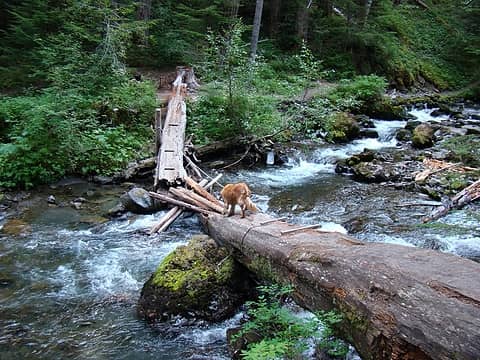 The first few pictures are from the last trip Abby, Jan and I did together in August, 2008. We went up the Dungeness to Goat Lake and returned via a cross county route. Moments after this picture was taken, Abby decided to go for a swim on the upstream side of the foot log. Needless to say, she found herself in a difficult situation. Jan's quick reactions prevented an unhappy outcome. 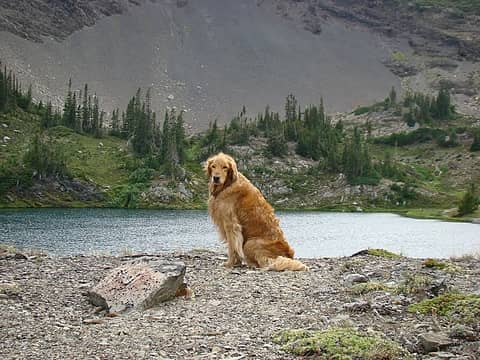 Abby at Goat Lake, 2008 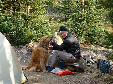 Jan and Abby enjoying the evening sun at Goat Lake, 2008. 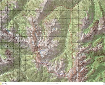 With no definite plans for Labor Day Weekend, Jan and I made an impromptu decision Friday evening to take advantage of some of the best weather of this "summer" to hike in the eastern Olympics. Earlier this year, our constant hiking companion, Abby (our Golden Retriever) passed away. We have looked for the right time to take a portion of her ashes into the mountains she so enthusiastically enjoyed with us for many years. This weekend proved to be the right opportunity. This is a map of our selected route. The clockwise route starts and ends at the Dungeness Trailhead. Our goal was to ascend the Dungeness River Trail to Constance Pass, then continue on to Sunnybrook Meadows. From here we would do a cross country traverse through Gunsight Pass continuing on to Deception Basin. We would complete the trip by crossing the col leading to Royal Basin and returning to the Dungeness trailhead through this beautiful area. 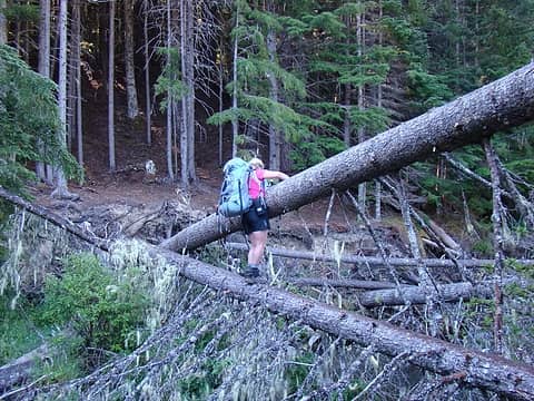 We followed the main Dungeness trail a couple miles to the new foot bridge. Here we decided to take a way trail on the west side of the river which leads to the large meadow at Camp Handy. This picture is of Jan crossing the natural foot bridge leading back to the main trail on the east side of the river. 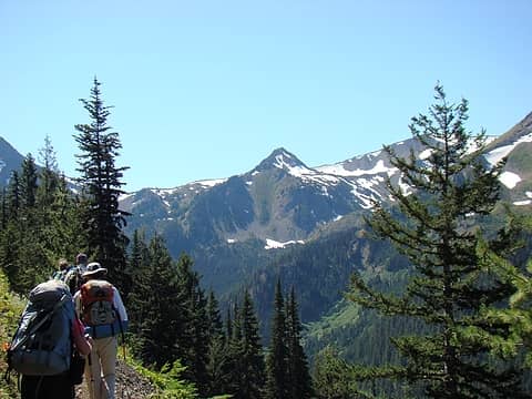 On the way to Boulder Shelter, we met up with a group of six hikers headed for Constance Pass. At the Shelter we ate lunch together talked for a while. 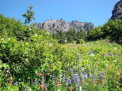 The September wildflowers are incredible. 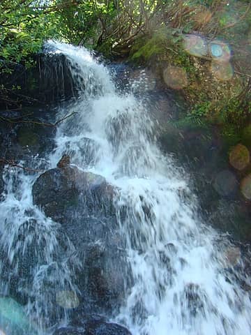 My marginal effort to capture the power and beauty of this water fall along the upper Dungeness trail. 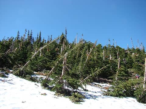 Just below Home Lake we ran into the remnants of a large spring avalanche. Note how far above ground level the trees are broken off. As the trail was obscured by the persistent snow and debris, the route finding to Home Lake was a bit tricky through this section. 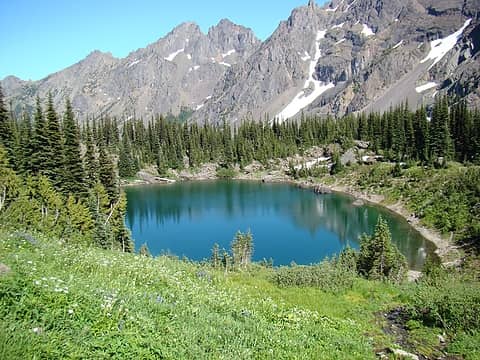 Persistence paid off and we finally found our way to Home Lake. Here we met a dad and his two teenage sons. They had experienced similar challenges finding the route to the lake. Their plan was to spend the night here and head for Marmot Pass the next day. 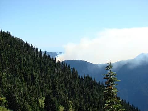 After reaching Constance Pass, we were surprised to see smoke spreading westward across the mountains. It originated from a human caused forest fire (we later learned) in the Duckabush River drainage. 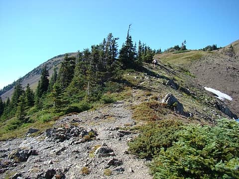 Jan climbing the trail to the ridge line above the meadows. 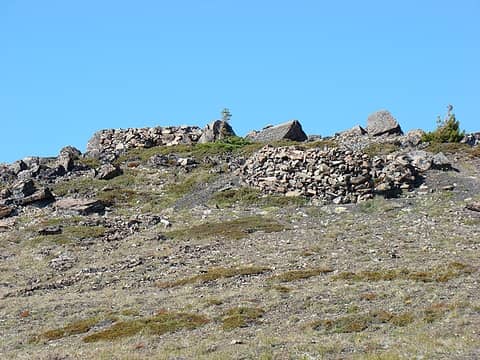 The unique man-made shelters at the top of the ridge. We had visited these several years ago, so we elected to bypass them in favor of an earlier arrival at our overnight campsite. 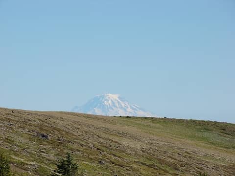 Looking back across the ridge at Mt. Rainier. 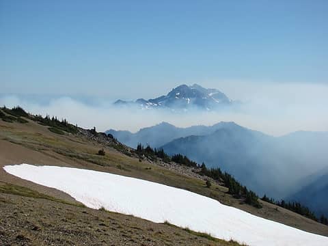 Looking SE at the ever increasing smoke from the Duckabush fire. 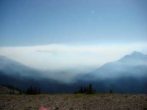 By early evening, the western Olympics were totally obscured by smoke from the fire. 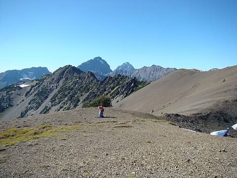 Jan arriving at our selected campsite for Saturday night. Our water supply is visible in the lower right of the picture. 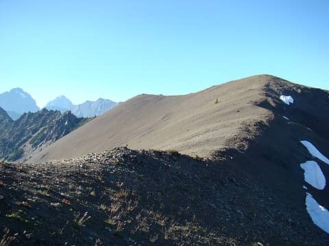 Looking westward along the route to upper Heather Creek Basin. After dinner I decided to walk over and check out the basin. 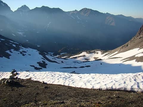 Looking down into upper Heather Creek Basin. Hard to believe it's September. There is almost 1,000 vf of continuous snow from the ridge line to the melted out meadows below. 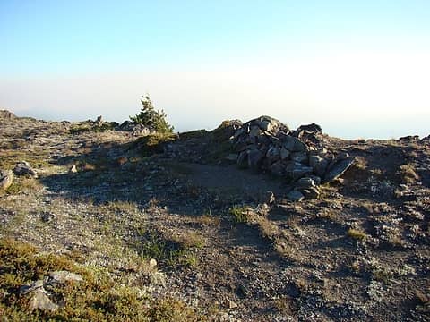 Someone went to a lot of effort to build this bivy shelter on the ridge above Heather Creek Basin. 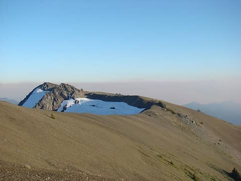 Looking back at our campsite from the ridge above Heather Creek Basin. Our tent is on the ridge just above the right side of the visible snow. 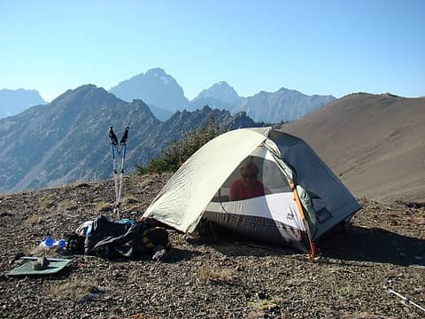 The winds shifted to the west later in the evening. This blew much of smoke from the fire back to the east. Jan enjoying the ever improving scenery. 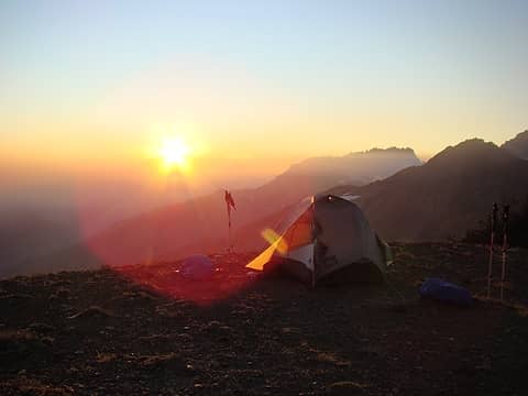 Sunset 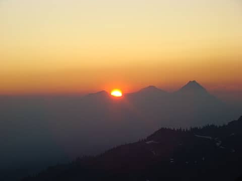 Jan captured the blazing red sun just before it set. 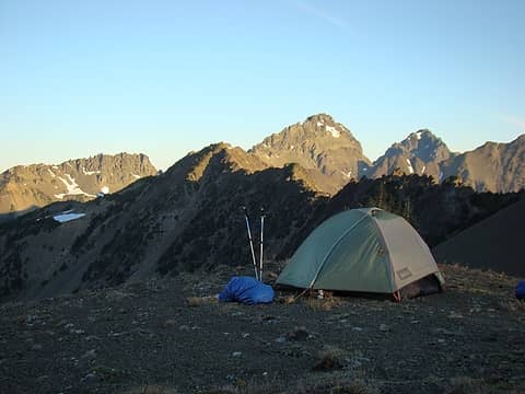 We woke up on Sunday morning to warm, crystal clear conditions. 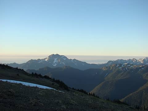 Looking back to the east at daylight, no signs of the fire. 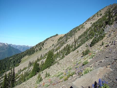 The jagged ridge line made for an easy decision to descend from our campsite towards Sunnybrook Meadows. We then traveresed this slope. Our intended goal is the flat ridge line in the upper-center of the picture. 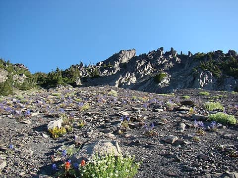 Wildflowers along the traverse. 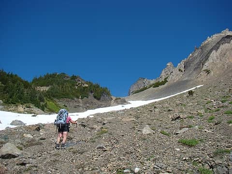 Jan starting the final climb to Gunsight Pass. 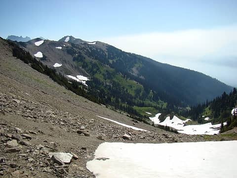 Looking back at our route from Gunsight Pass. 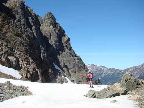 Jan at Gunsight Pass 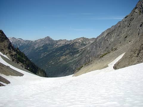 Looking down the route ahead from Gunsight Pass.  Gary enjoying the glisade down from the pass. 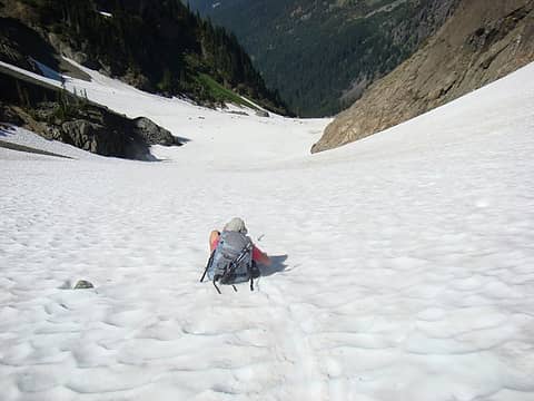 Jan breaking trail through the suncups. 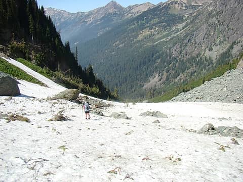 At lower elevation avalanche debris and rockfall forced us to transition from enjoyable butt sliding to more tedious walking. Jan descending into the lower basin below Gunsight Pass. 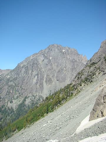 Our first views of Mt Deception. Just below here, at about elev. 4,800 ft we found a break in the Slide Alder and decided to make the traverse across the shoulder of Mt Mystery to the Deception Creek drainage. This creek is between Mt Mystery and Mt Deception, it drains from Deception Basin, our intended campsite for night 2. The rather short traverse proved to be difficult and challenging. We were forced to cross sections of avalanche debris, slide alder and jumbled rock in order to reach Deception Creek. 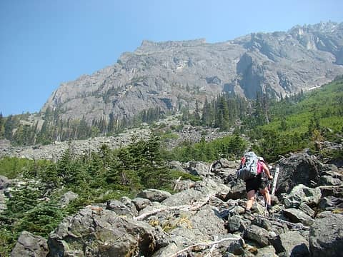 Once we reached the Deception Creek drainage, we were greeted with relatively easy travel through large, stable talus. Jan climbing towards Mt Mystery. 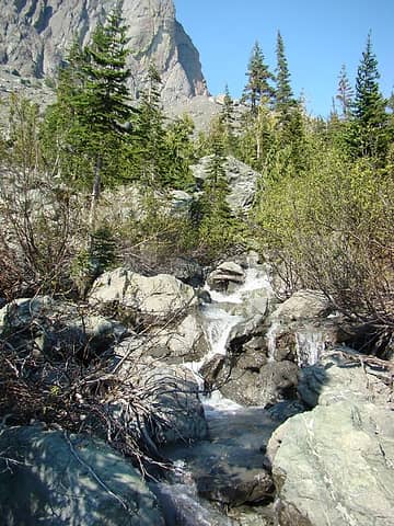 As we ascended the drainage, the terrain forced us climber's left towards Deception Creek. We arrived at the creek at an excellent crossing point. 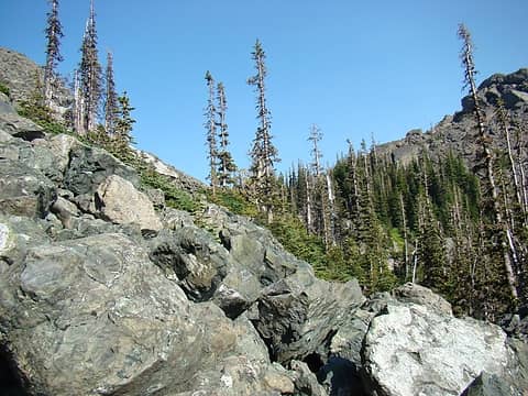 After crossing the creek, we ascended the final steep section of talus to lower Deception Basin. This picture is looking up the final climb to the basin. 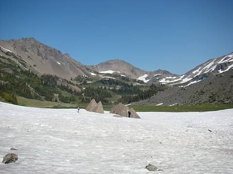 The flat terrain of Deception Basin was a welcome sight after a day in the vertical world. Jan crossing the final snow field to our intended campsite for night 2. 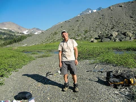 We made it! 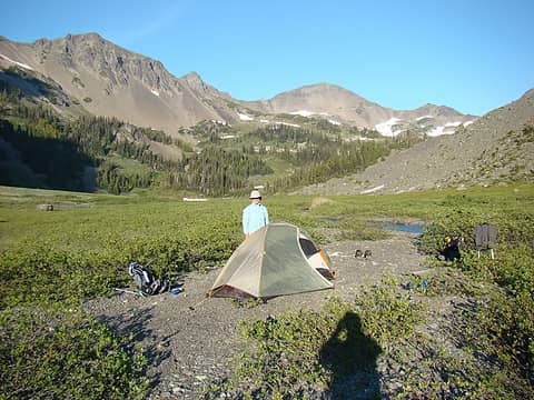 Jan with Deception Basin in the background. 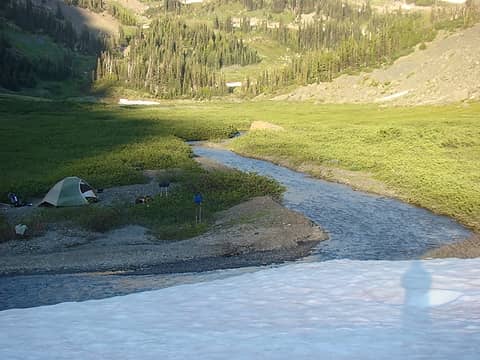 Evening shadows spreading over camp.  We awoke the next morning to frosty pack covers. 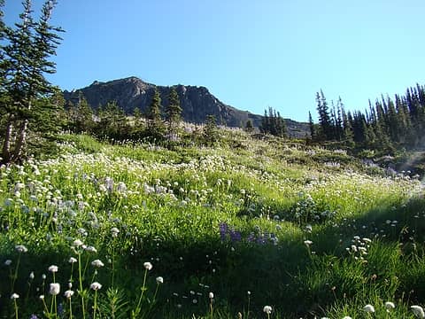 Our route to upper Deception Basin lead us through more beautiful wildflowers. 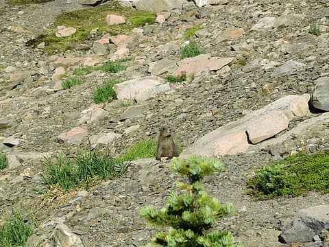 Jan made friends with one of the local inhabitants of the basin. 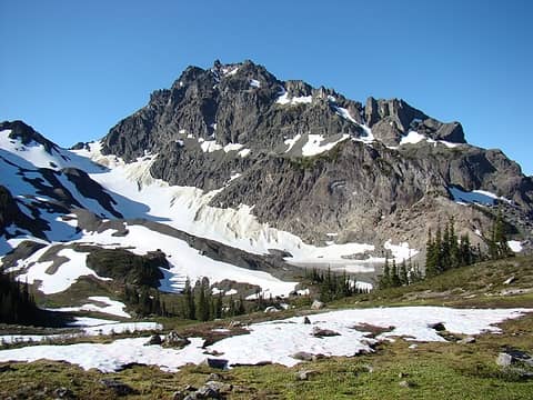 Mt Mystery, the Mystery Glacier and the partially melted out lake at base of the glacier. 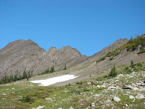 Our route ahead to the col leading to Royal Basin. The way trail is visible in the distance. 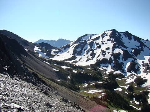 Hal Foss Peak and upper Deception Basin. 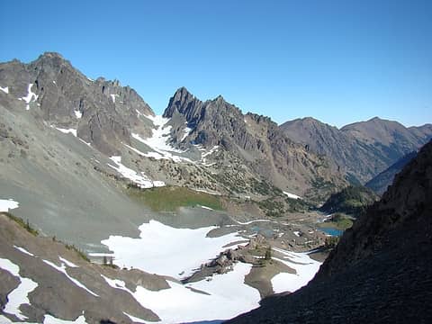 Upper Royal Basin from the the col. Surprise Pass in the distance. 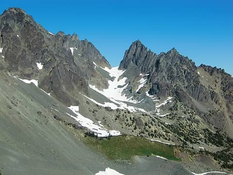 A closer look at Surprise Basin. 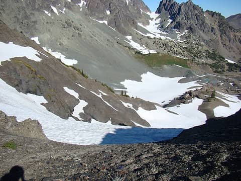 When we arrived at the col, we found much of the upper slope still in shade, the snow was very hard. We elected to wait about an hour for the sun to work it's magic and soften the snow before descending. 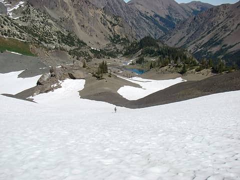 Once we felt conditions were safe, we made a cautious descent down the steep upper slope. After safely reaching flatter terrain, we started the hike back to civilization. Jan headed for the lakes in upper Royal Basin. 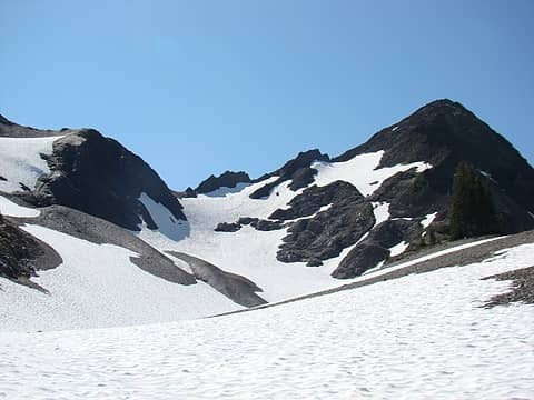 Looking back at our descent route from the col separating Royal Basin from Deception Basin. Our glisade track is faintly visible in the main snow chute. 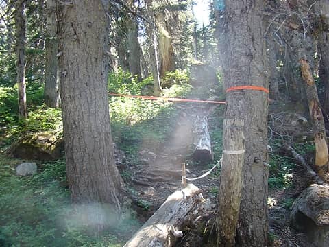 As we neared Royal Lake we crossed this "Trail Closed" sign. This was prompted by reports of an aggressive goat in the upper basin. We learned today (9/7/11) the goat has been lethally removed . 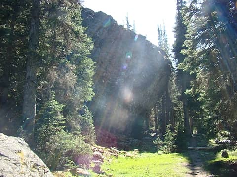 Shelter Rock 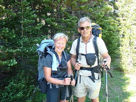 Jan and I near Royal Lake. 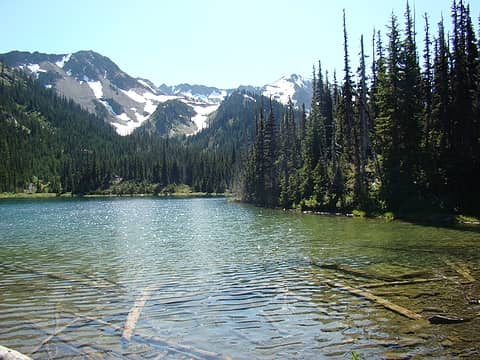 Royal Lake and surrounding environs. 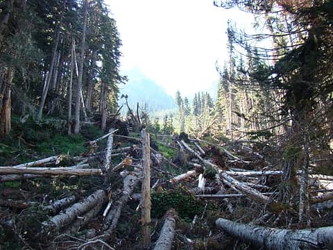 One of several major avalanche paths along the Royal Creek trail.
|
| Back to top |
  
|
|
Ancient Ambler
Member

Joined: 15 May 2007
Posts: 1092 | TRs | Pics
Location: Bainbridge Island |
Excellent trip, report and photos, Gary-n-Jan. That's a challenging and very scenic route to Deception Basin. It was great to meet you up there on the way to Constance Pass, and I'm looking forward to more of your fine trips, reports and photos.
|
| Back to top |
|
|
silence
Member

Joined: 25 Apr 2005
Posts: 4420 | TRs | Pics
|
|
silence
Member
|
 Sun Sep 18, 2011 3:46 pm |
|
|
you're a sly one gary .. ha no mention of this trip in your email .. this is one we have longed to try .. after doing it via heather creek with a lot of beta from greg (thank you sir) .. i've read about it a lot and people say it sucks (maybe they were talking about the traverse fm mystery to deception creek?) .. but still i think you got the best of conditions .. way to go you guys! like i said .. you're my inspiration ... and greg .. you are too 
PHOTOS
FILMS
Keep a good head and always carry a light bulb. Bob Dylan
PHOTOS
FILMS
Keep a good head and always carry a light bulb. Bob Dylan
|
| Back to top |
|
|
bobbi
stillaGUAMish

Joined: 13 Jul 2006
Posts: 8012 | TRs | Pics
Location: olympics! |
|
bobbi
stillaGUAMish
|
Sun Sep 18, 2011 4:58 pm |
|
|
bobbi ૐ
"Today is your day! Your mountain is waiting. So
get on your way!" - Oh, the Places Youll Go! By Dr. Seuss
|
| Back to top |
|
|
Gary-n-Jan
Member
Joined: 25 Aug 2009
Posts: 56 | TRs | Pics
|
| silence wrote: | | you're a sly one gary .. ha no mention of this trip in your email .. this is one we have longed to try .. after doing it via heather creek with a lot of beta from greg (thank you sir) .. i've read about it a lot and people say it sucks (maybe they were talking about the traverse fm mystery to deception creek?) .. but still i think you got the best of conditions .. way to go you guys! like i said .. you're my inspiration ... and greg .. you are too |
I had hoped to post this last week before we headed out, but didn't quite get it finished........
This is a beautiful and interesting route, .......... with the exception of the traverse from Mystery (below Gunsight Pass) over to Deception Creek. We did not see an easy way to get across this section. Up high is cliffs, below this is Slide Alder, brush, Devil's Club and dense trees. Further down is a mixture of all of the above plus avalanche debris. We chose the middle section, very tedious bushwhacking.
The route up Heather Creek is more straight forward and equally or more scenic.
| bobbi wrote: | sorry about Abby  you two are animals!
  missed you at home lake....omg was there sept 4 as our plans for the upper royal basin was nixed because of the now dead goat.
we may have met up with the father and two sons on their way out after having camped along the ridge.
ha! i think i can see 'bobbi's boulder' on your photo of URB from the col
missed you at home lake....omg was there sept 4 as our plans for the upper royal basin was nixed because of the now dead goat.
we may have met up with the father and two sons on their way out after having camped along the ridge.
ha! i think i can see 'bobbi's boulder' on your photo of URB from the col  thanks for sharing......
Jan: i'll see you Tuesday!
thanks for sharing......
Jan: i'll see you Tuesday! |
Hi Bobbi,
Looks like you guys had a fun time at Home Lake, I remember swimming there a few years ago with Jan, the boys and the Fox family, lots of fun!
You may very well met the same dad and boys we talked to, they were going to head for Marmot Pass on Sunday.
Thanks for the thought about Abby, we miss her .............
Gary
|
| Back to top |
|
|
puzzlr
Mid Fork Rocks

Joined: 13 Feb 2007
Posts: 7220 | TRs | Pics
Location: Stuck in the middle |
|
puzzlr
Mid Fork Rocks
|
Mon Sep 19, 2011 1:53 am |
|
|
Great trip -- looks like you had good weather.
|
| Back to top |
|
|
Phil
Member

Joined: 02 Jul 2003
Posts: 2025 | TRs | Pics
Location: Shoreline, WA |
|
Phil
Member
|
Tue Sep 20, 2011 11:11 am |
|
|
| Gary-n-Jan wrote: | Once we felt conditions were safe, we made a cautious descent down the steep upper slope. After safely reaching flatter terrain, we started the hike back to civilization. Jan headed for the lakes in upper Royal Basin. |
What a great TR ! Del Monte ridge looks like a great walk, the traverse that follows, less so.
Sounds like the descent to Royal Basin was safe without axe ?
|
| Back to top |
|
|
Parked Out
Member

Joined: 18 Sep 2011
Posts: 508 | TRs | Pics
Location: Port Angeles, WA |
What a great trip! All the off-trail travel makes it really interesting. I haven't been to any of these places and want to see them all now. Very inspiring!
|
| Back to top |
|
|
Gary-n-Jan
Member
Joined: 25 Aug 2009
Posts: 56 | TRs | Pics
|
| Phil wrote: | | Sounds like the descent to Royal Basin was safe without axe ? |
Phil,
The steep upper section of this descent (see pix above) was a bit tricky. We did use our ice axes and our Microspikes We arrived at the col about 10 am, the climber's left side was still in the shade and frozen solid. We waited until well after 11 for the sun to soften the top 2 -3" of snow. Underneath this layer it was still frozen.
We made a very controlled glissade down through pretty good sized sun cups. It was a bumpy ride, fortunately, the runout was safe.
Regular boot crampons would have made this much easier, however we elected not to bring them on this trip.
Gary
|
| Back to top |
|
|
Phil
Member
Joined: 02 Jul 2003
Posts: 2025 | TRs | Pics
Location: Shoreline, WA |
|
Phil
Member
|
Wed Sep 21, 2011 12:22 pm |
|
|
Thanks for the added info on that tricky descent. Was eye-balling that area for inclusion in part of a hike in a couple weeks but would not be bringing any spikes or axe. You were there labor day weekend, not sure if it's possible that it would melt out by then.
|
| Back to top |
|
|
|
|
You cannot post new topics in this forum
You cannot reply to topics in this forum
You cannot edit your posts in this forum
You cannot delete your posts in this forum
You cannot vote in polls in this forum
|
Disclosure: As an Amazon Associate NWHikers.net earns from qualifying purchases when you use our link(s). |


