Edit: This is my second trip camping at "Jagged point". which I've just learned is actually named Coastie Head.
And the "cabin remnants" are actually the remains of the Coastie Head Shelter. There's a picture of the cabin here.
Walked from Sand Point down to Cedar Creek/Jagged Island Beach, which was my turn-around point on a northbound trip last year. I bailed on that trip (meant to be a thru hike) after spending a few nights in the rain at Jagged.
I had exceptionally good weather for the entire trip this time, which was extremely helpful for completing the rocky section between Yellow Banks and Norwegian Memorial.
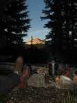
Left town in a hurry, forgetting my sleeping pad and headlamp; didn't realize the mistake until I was at Lake Ozette. So, I took my lantern and slept in my clothes.
The boardwalk is in great shape, with lots of recent work. Sand Point was deserted when I arrived about half an hour before sunset. Walked past the well used campsites and slept on the sand south of the second creek.
Sandy
Sand Point
White Rock and Ozette Island
I spent the next day wandering around looking at things. Whole buildings are washing in as single posts and beams.
At the north end of Yellow Banks I walked around the tidepools and found a dense colony of starfish at the bottom of the tiny creek.
Starfish at Yellow Banks
Stars Reflecting
There are lots of squishy, alien looking things here.
South of YB, there are some downed trees/logs blocking the upper beach. Fortunately the rocks were dry, so I had a pretty easy trip.
Logs and trees
Ski in tree
Lots of new tires on the beach:
Sporty Wheel
Norwegian/Kayos Beach was crowdy, so I went over the hill to Cedar Creek. It was crowdy too, so I camped on the sand over by the bottom of the ladder.
Kayostia/Kayostola/Norwegian
Kayos Beach
Going to Cedar Creek
There's a steep trail up from the saddle to the top of the rock overlooking Cedar:
View of Jagged Point from above saddle
Cedar Creek Rock
Cedar Creek Beach and Jagged Island
Cedar Sunset
Cedar Creek
Hikers on the beach at Cedar Creek.
Carrol Island
Pools
Tide Rock
Tide Rock and Jagged Island
Warm Pool
The trail over the hill north of Jagged Point has a nice view in both directions. There's a demolished cabin and a few rough campsites on the hill.
Jagged from cabin site on hill trail
Cabin remnants
Jagged seems to have less sand this year. The camp on the point is mostly gravel. There a couple of ok spots just south of the point.
Rocky this year
Cedar Creek from cabin site
Jagged in twilight
Cedar in the morning
South of Jagged Point the beach is full of tidepool rocks. I thought of camping at the south end of the beach, but it looked like the 7.5 tide might get a little too close.
South Jagged
Poolrocks
Jagged Reflection
Jagged
Further Reflection
South end of Jagged
End of Jaggedness
Terminus
Jagged Creek
Heading bback to Cedar Creek
I went back to Cedar Creek and camped in the grassy site next to the creek.
"Coastie Head"?
The remnants of the cabin are indeed the remains of a coast watch site. There were a number of coast watch posts established as part of the defense system early in WII. After the invason in the Aleutian Islands, there was concern that the Japanese would choose the unpopulated NW coast beaches as the best place to successfully invade the west coast.
The coastal watch stations, along with airships based at the Quilayute Airport (built by the Navy at the start of the war primarily to base and fly blimps) were the "early warning system" in between the lighthouses from Tatoosh down to Westport.
About 20 years ago, a Scout Troop from Bellevue put quite a lot of work into that cabin, trying to rescue it. One of the scouts proposed, researched, obtained NP approval, and then managed the project in order to to earn his Eagle. There was a 3 ring binder in the cabin with laminated pages outlining both the history of the Navy coast watch stations and the project to shore up / refurbish the cabin itself.
I've never heard that point referred to by any name other than "Lookout Point". Your link pointing to a Coast Guard background for the cabin is very interesting. I wonder why the scouts' research didn't uncover it.
Spent a stormy night in that cabin about 30 years ago. The mice were fierce.
Really nice photos, looked like a fun trip. Kind of surprised that you didn't get pix of the rusty remnants of the mining equipment at Starbucks, or the old steam donkey just inside the treeline on the South shoulder of Cedar Creek. I guess you'll just have to go back....
strider
I've never been lost, but I'm frequently uncertain where my destination might be in relation to where I am at the moment....
0
strider
I've never been lost, but I'm frequently uncertain where my destination might be in relation to where I am at the moment....
I came for the pictures contour, not disappointed
Looks & sounds like a great trip despite the bedding improv
http://david-inscho.smugmug.com/
The key to a successful trip is to do the planning during work hours. -- John Muir
My most memorable hikes can be classified as 'Shortcuts that Backfired'. --Ed Abbey
0
http://david-inscho.smugmug.com/
The key to a successful trip is to do the planning during work hours. -- John Muir
My most memorable hikes can be classified as 'Shortcuts that Backfired'. --Ed Abbey
You cannot post new topics in this forum You cannot reply to topics in this forum You cannot edit your posts in this forum You cannot delete your posts in this forum You cannot vote in polls in this forum
Disclosure: As an Amazon Associate NWHikers.net earns from qualifying purchases when you use our link(s).


 Looks & sounds like a great trip despite the bedding improv