| Previous :: Next Topic |
| Author |
Message |
Sadie's Driver
Sadie's Driver


Joined: 24 Apr 2006
Posts: 1763 | TRs | Pics
Location: Welcome Pass |
OK, OK, I'm a little tardy getting these photos up - I probably have way too many pictures, but it's such a gorgeous area, one gets a bit carried away.
Let's start from the beginning - "Someone" was having a birthday . . .
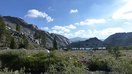
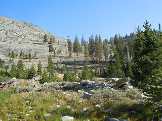
 One birthday boy celebrating #70 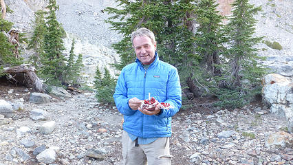 Birthday Boy with his Red Velvet Cake (complete with candle!) 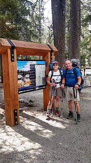 Ha, they're smiling now! 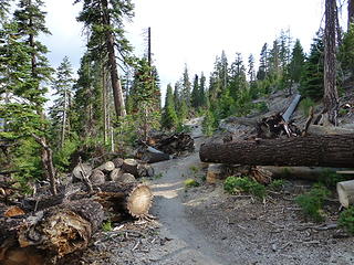 Some of the blowdown from 2011 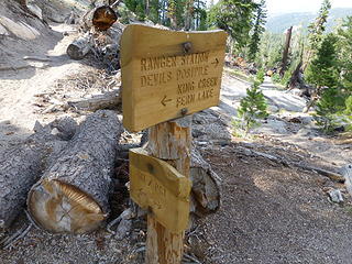 Once on the trail, we could have gone anywhere, but were good hikers and went to Fern Lake as we were told 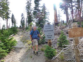 As we start into the Ansel Adams Wilderness - lots of blowdown from the storm of November 2011 (closed the access to Devils Postpile in 2012 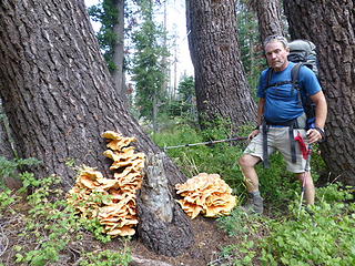 Dinner? Amazing 'shrooms 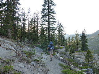 Losing light as we head into Fern Lake 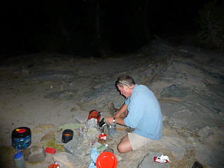 Fixing dinner at Fern Lake 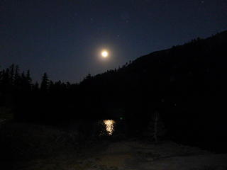 Full Moon above Fern Lake 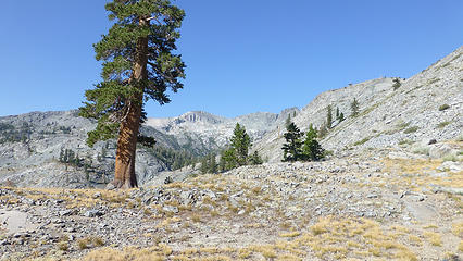 Barren compared to the heavily forested area around Fern Lake 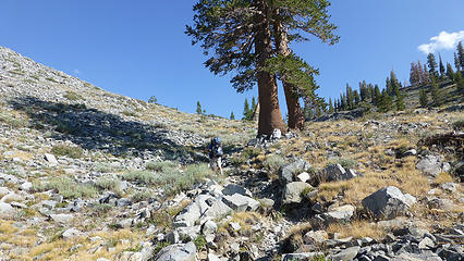 Heading up toward King Creek 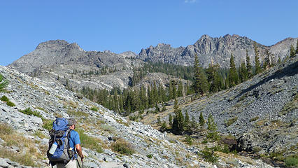 A real change in scenery as we head up the King Creek drainage 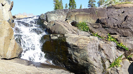 Nice little waterfall on King Creek - with lovely little yellow flowers 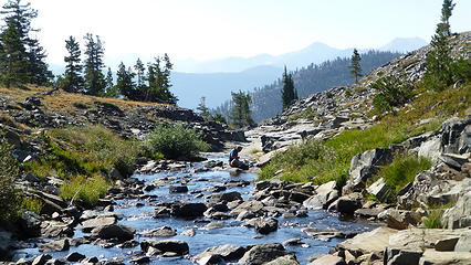 King Creek 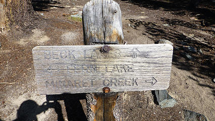 We would leave the official trail not long after this sign 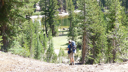 Coming up on Lost Dog Lake 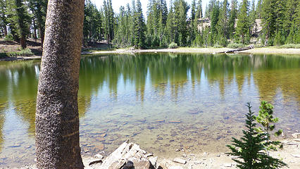 Lost Dog Lake - didn't find any 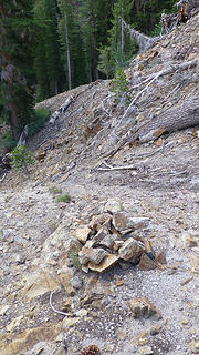 What? We weren't the first ones to use this route? 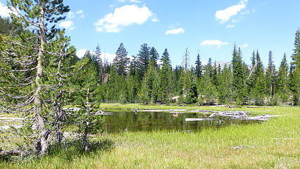 The wet spot 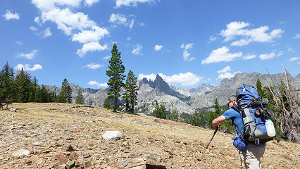 Our cross-country route to save some mileage 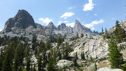 The Minarets ahead of us - spectacular 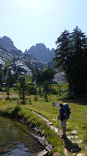 On the way to Minaret Lake 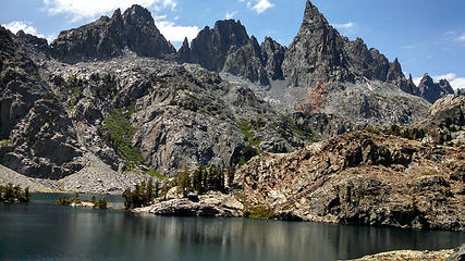 Minaret Lake 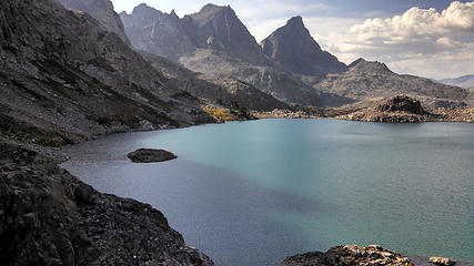 Lake Cecile at the base of the Minarets - absolutely gorgeous 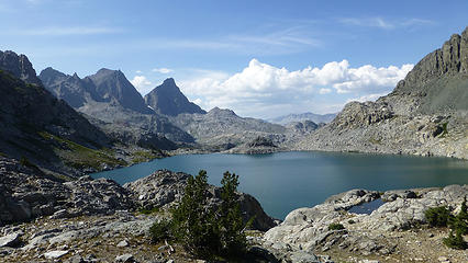 Lake Cecile with bathtub tarn in the lower right hand part of the picture 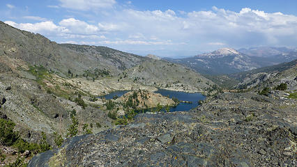 Looking down on Minaret Lake 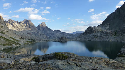 Cecile in the morning light 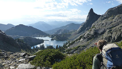 Looking back toward Minaret Lake 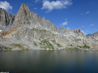 Minarets on the west side of Cecile 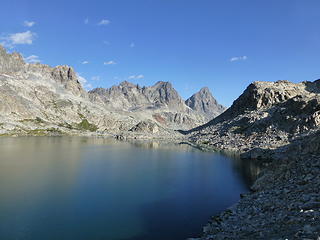 Beautiful Cecile in the morning sun 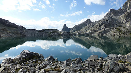 We will scramble over LOTS of boulders on the east (right side) of Lake Cecile 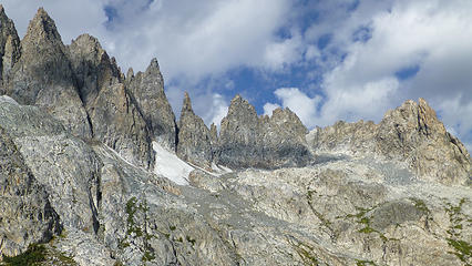 The Minarets - lovely to look at. I had no burning urge to climb them! I'll leave that for Sjolseth! 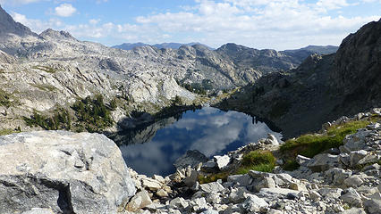 Looking down to Iceberg Lake from the Cecile outlet stream 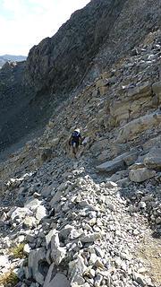 Actually - not a bad trail . . a bit scrambly 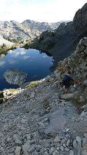 Looking ahead to Iceberg lake from the trail 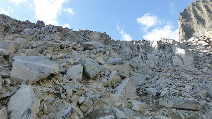 This is our "route" down from Cecile 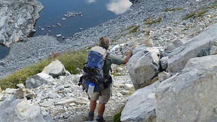 The start of the descent from Cecile to Iceberg (below) - cairn by Barry's right hand 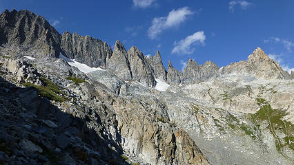 Looking up to the Minarets from the outlet of Cecile 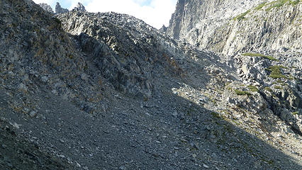 This is the "trail" from Cecile Lake down to Iceberg Lake 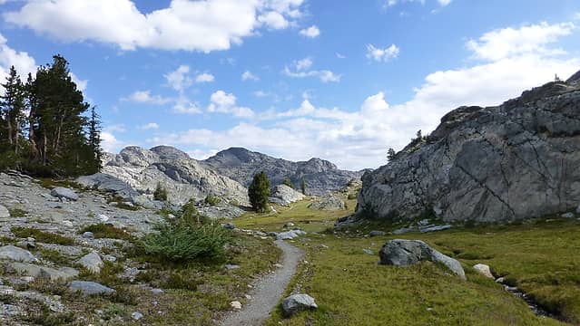 More of the Iceberg - Ediza trail 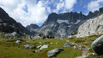 The basin below Iceberg Lake - a lovely trail to take down to Ediza 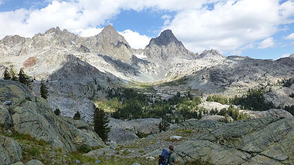 Coming down from Iceberg Lake - Mt. Ritter on the left and Banner Peak on the right in the distance. 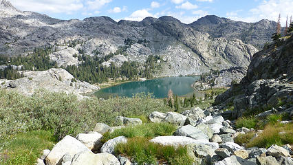 Looking down on Lake Ediza 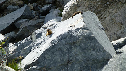 Marmot sun rock 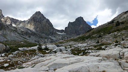 Approaching the upper basin below Ritter and Banner 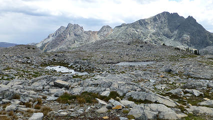 Little 'Divers I named Sadie and Gus 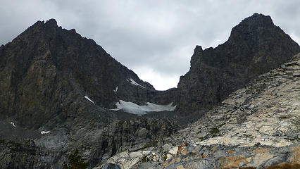 Mt. Ritter and Banner Peak 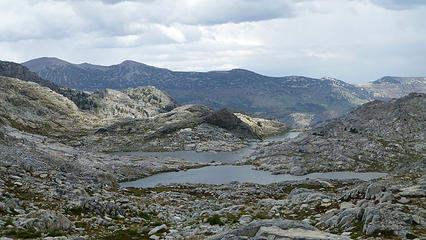 Nydivers (looking east) 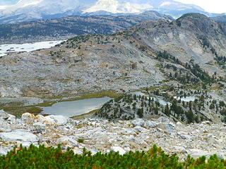 Looking to upper Garnet Lakes and 1000 Island Lake (looking west from Nydiver Saddle) 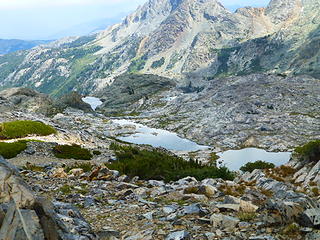 Nydiver Lakes looking southeast 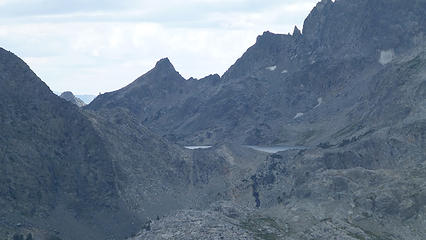 Iceberg Lake zoomed in from Nydiver Ridge (looking south from Nydiver Ridge) 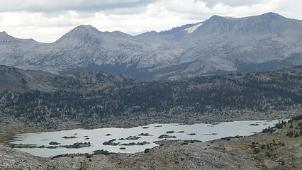 1000 Island Lake looking west 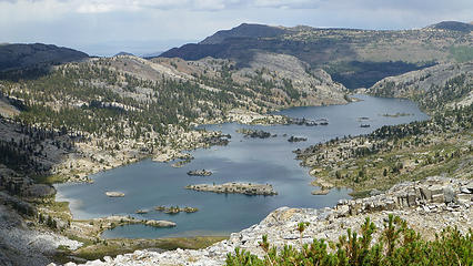 Garnet Lake looking north 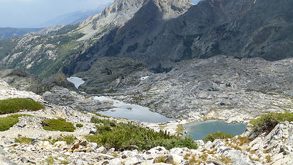 Nydivers from Nydiver Pass 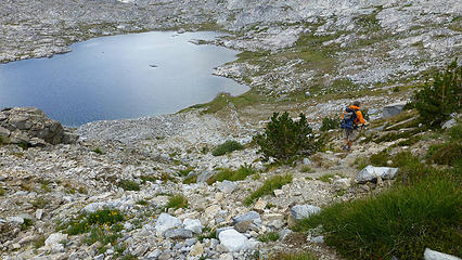 Coming down the ridge/Nydiver Pass to the western Nydiver lake 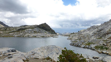 Lower Nydiver (to the east) 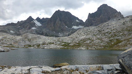 On the Isthmus between the two Nydiver Lakes 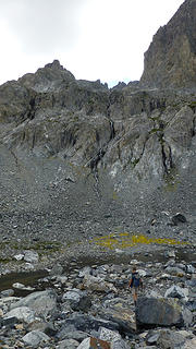 Yellow flowers from a distance 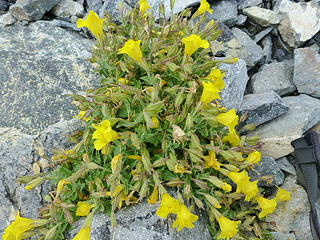 Cluster of yellow flowers 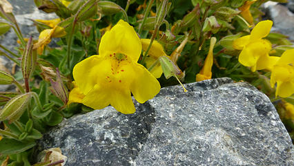 Looks like a cross between an orchid and a snapdragon! 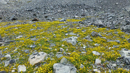 Carpet of yellow flowers at the base of Mt. Ritter/Banner Peak 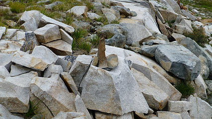 Clever little cairn as we were coming down from Nydiver Lakes 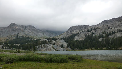 Lake Ediza with low clouds 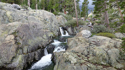 Shadow Creek 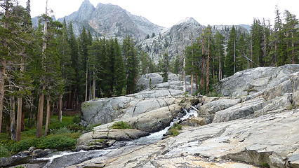 Shadow Creek 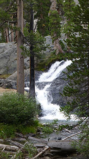 Falls coming from Lake Ediza along Shadow Creek 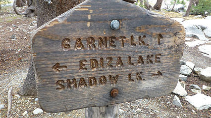 Joining the John Muir Trail (JMT) from Lake Ediza 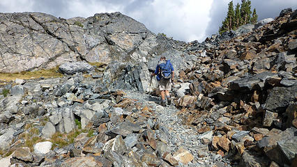 Walking the JMT between Lake Ediza and Garnet Lake 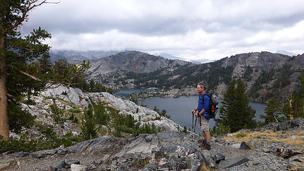 John Muir Trail (JMT) high above Garnet Lake in the background 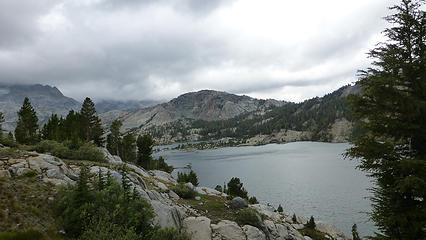 Garnet Lake as we were coming down the John Muir Trail from Lake Ediza 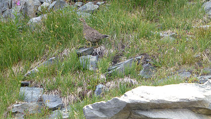 Mr/Ms Grouse clucking at us 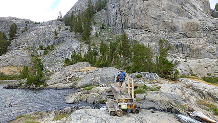 Bridge cross on the north end of Garnet Lake (John Muir Trail) 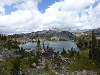 Emerald Lake 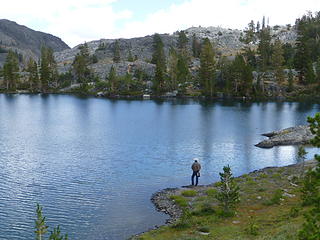 Lone fisherman at Emerald Lake (on the John Muir Trail) 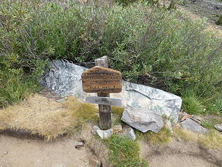 Junction of John Muir Trail and Pacific Crest Trail at 1000 Island Lake 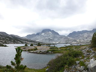 At the north end of 1000 Island Lake - Banner in the clouds 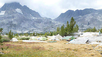 Looking toward Banner Peak (to the south) from trail along the west side of the lake - lots of people camping 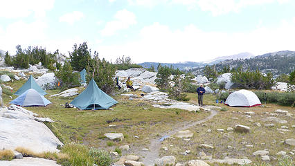 Tent City at 1000 Island Lakes 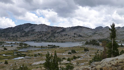 1000 Island Lake from the southwest side 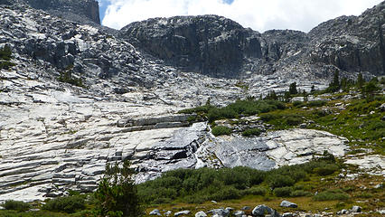 Looking up towards the route from 1000 Island Lake to Lake Catherine 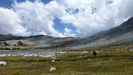 South end of 1000 Island Lake at the base of Banner Peak (looking to the saddle between 1000 Ils and Garnet) 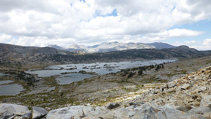 Garnet Lake looking north 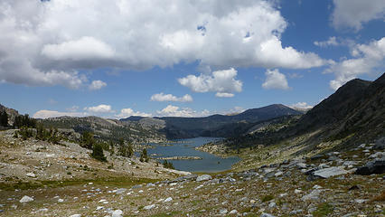 Nydiver 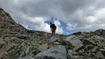 Barry heading up to the Nydiver Pass above Garnet Lakes 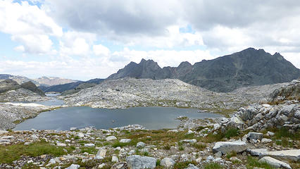 Nydiver Lakes - no real trail to them 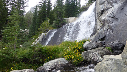 Falls above Lake Ediza heading toward the Nydiver Lakes 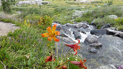 Flowers at Lake Ediza - almost looks like a Tiger Lily, but not quite  - but feeling good because we had covered so much territory and saw so many great places. A few spots I would like to explore a bit more, but we packed a lot in. I loved the trip to Shadow Lake and dropping down from there. Lovely. - but feeling good because we had covered so much territory and saw so many great places. A few spots I would like to explore a bit more, but we packed a lot in. I loved the trip to Shadow Lake and dropping down from there. Lovely.
 Tent sites on the south end of Lake Ediza 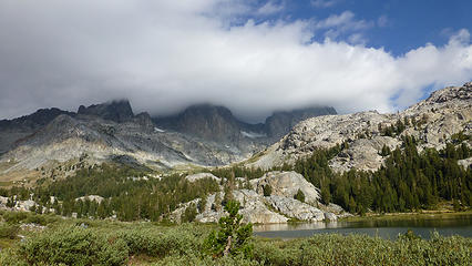 Leaving Lake Ediza on 08/13 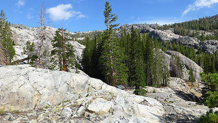 Classic granite terrain 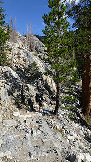 Terrain from Lake Ediza to Shadow Lake 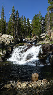 Shadow Creek falls 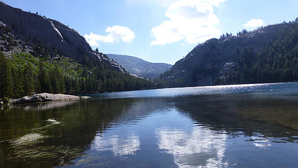 Shadow Lake reflections 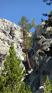 Tree growing out of a rock! 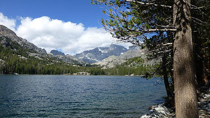 Shadow Lake 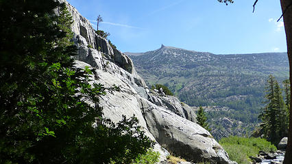 In distance - one of the two Teats 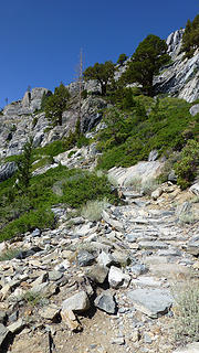 Shadow Lake trail down to the River trail 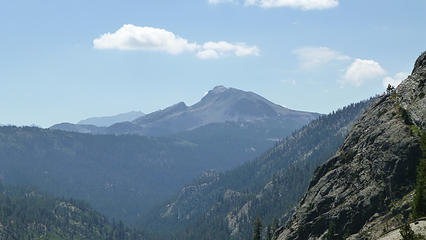 Mammoth Mountain as seen from the Shadow Lake trail 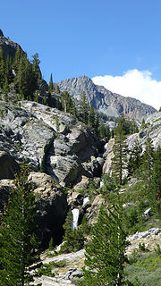 Beautiful falls from Shadow Lake 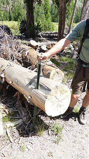 Blowdown that simply went right through the stake 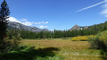 Agnew Meadow 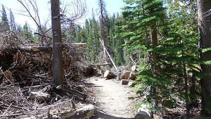 2011 blowdown near Agnew Meadow  
Four-paw buddy lets me tag along!
Four-paw buddy lets me tag along!
|
| Back to top |
  
|
|
Roly Poly
Member

Joined: 02 Jan 2013
Posts: 713 | TRs | Pics
|
Too funny! I just got back from the Sierras this evening. I probably stepped over your footprints in the sand.
|
| Back to top |
|
|
olderthanIusedtobe
Member
Joined: 05 Sep 2011
Posts: 7722 | TRs | Pics
Location: Shoreline |
Wonderful pics and trip! I've poked around all of those lakes on several different trips. Love that area. I continue to believe that the Ansel Adams and John Muir Wildernesses are every bit as good as Yosemite, Kings Canyon and Sequoia NP's. Thanks for sharing, looking forward to the rest of your trip.
|
| Back to top |
|
|
olderthanIusedtobe
Member
Joined: 05 Sep 2011
Posts: 7722 | TRs | Pics
Location: Shoreline |
I camped at Minaret Lake last summer. I thought it was quite a bit easier to get to Cecile from Minaret than it was to descend to Iceberg from Cecile.
Also the meadows around Iceberg's outlet is absolutely lovely, your pics bring it all back to my mind.
|
| Back to top |
|
|
Middle E
no more moustache

Joined: 10 Feb 2008
Posts: 432 | TRs | Pics
Location: Seattle, WA |
|
Middle E
no more moustache
|
 Mon Aug 25, 2014 8:12 am |
|
|
Yes, it was a fantastic 5 days of spectacular scenery, mostly good weather, and no bugs! Although we had talked about Mt. Ritter, it became clear that this was never a realistic option given the distance we had to cover, and the weather would have precluded it anyway. But we then had lots of time to visit lots of the lake and ridges, both on and off trail. Oh, and it was my birthday too  I don't know how this happens, but my pictures all look about the same as Suzanne's.
 Getting higher the terrain opens up 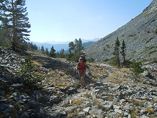 Suzanne on the trail 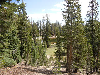 Lost Dog Lake 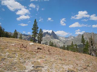 Minarets appear ahead 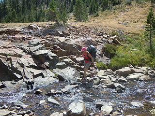 Crossing Minaret Creek 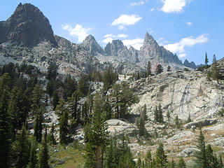 Minarets ahead 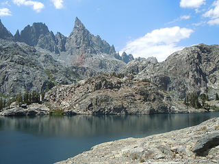 Minaret Lake 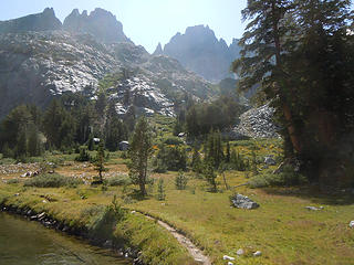 Looking toward the route up to Cecile Lake 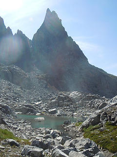 Clyde Minaret (highest) and a tarn 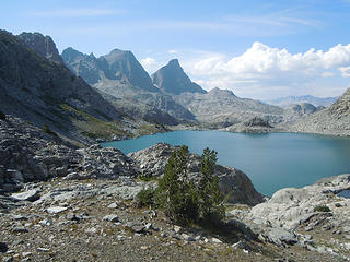 Cecile Lake - home for the night 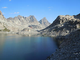 Circling Cecile Lake 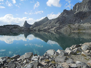 Cecile Lake from the outlet end 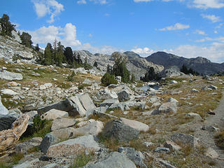 Leaving Iceberg Lake 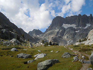 Minarets from below Iceberg Lake 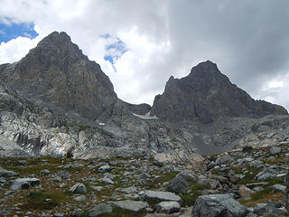 Right below Ritter and Banner 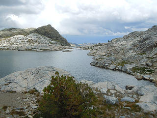 Nydiver Lakes 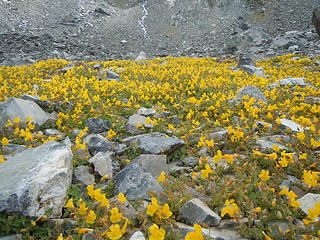 Primrose Monkeyflower 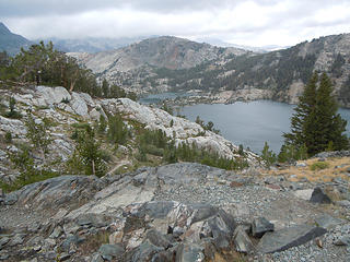 Looking down on Garnet Lake 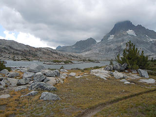 Thousand Island Lake 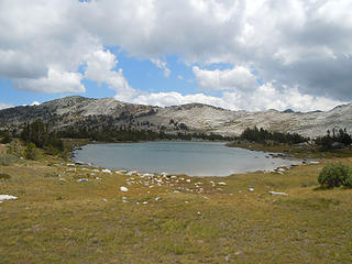 No Island Lake 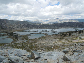 Looking down on Thousand Island Lake 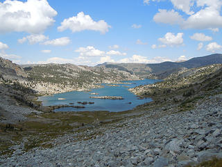 Garnet Lake 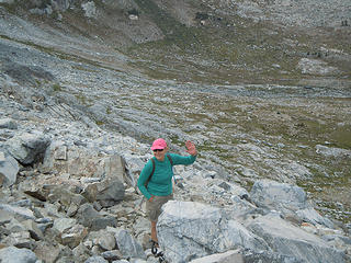 Climbing up to Nydiver pass 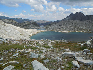 Nydiver Lakes 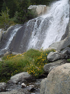 Waterfall 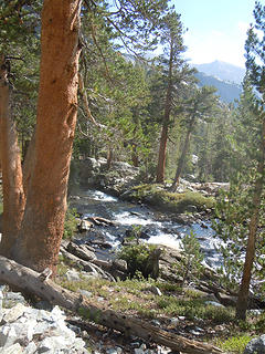 Shadow Creek 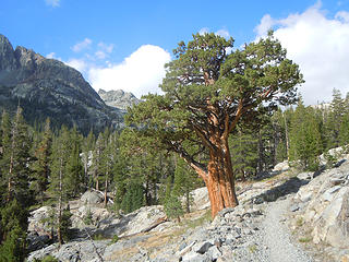 Gnarly pine 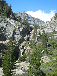 Cascading Shadow Creek 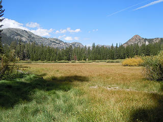 Agnew Meadows
pithy yet insightful signature
pithy yet insightful signature
|
| Back to top |
|
|
Bloated Chipmunk
Cock Rock Searcher

Joined: 29 Jan 2007
Posts: 2993 | TRs | Pics
Location: Margaritaville |
Timely report -- we're headed to 1000 Is. Lk. this wknd.... 
Home is where the hiking is.
"Peaks that have come and gone four times should halt a man in his steps." -- William O. Douglas
A balanced diet is a margarita in each hand.
Home is where the hiking is.
"Peaks that have come and gone four times should halt a man in his steps." -- William O. Douglas
A balanced diet is a margarita in each hand.
|
| Back to top |
|
|
ree
Member

Joined: 29 Jun 2004
Posts: 4399 | TRs | Pics
|
|
ree
Member
|
Mon Aug 25, 2014 9:29 am |
|
|
What a fabulous bday trip. Love all your pictures. Glad you had fun and enjoyed yourselves. We visited the area a few years ago - hiking from Yosemite to Mammoth. It is gorgeous wandering country. The Sierras are the bestest. (But I know what you mean about the long 3 miles, for sure.)
Happy birthday, MiddleE.
|
| Back to top |
|
|
Rich Baldwin
Mister Eddie

Joined: 22 Dec 2001
Posts: 1686 | TRs | Pics
Location: Martinique |
Nice photos, looks like a fantastic trip
Was you ever bit by a dead bee?
Was you ever bit by a dead bee?
|
| Back to top |
|
|
Sadie's Driver
Sadie's Driver
Joined: 24 Apr 2006
Posts: 1763 | TRs | Pics
Location: Welcome Pass |
| Keep Calm wrote: | | Too funny! I just got back from the Sierras this evening. I probably stepped over your footprints in the sand. |
Ha! We wondered if we might bump into you on the JMT!
| Bloated Chipmunk wrote: | | Timely report -- we're headed to 1000 Is. Lk. this wknd.... |
BC - My tip? Camp at the very south end of 1000 Island - or better yet, go over that little saddle in my pics and drop down to that end of Garnet Lake - a LOT fewer people and a fun place to wander. If you're really ambitious, head up to Nydivers or to Catherine!
Have fun.
Four-paw buddy lets me tag along!
Four-paw buddy lets me tag along!
|
| Back to top |
|
|
GeoTom
Member
Joined: 19 May 2005
Posts: 3215 | TRs | Pics
Location: Earth |
|
GeoTom
Member
|
Tue Aug 26, 2014 8:47 am |
|
|
Yeah, this is a little nicer than Smithbrook Road. 
|
| Back to top |
|
|
BarbE
Member

Joined: 28 Jul 2006
Posts: 1153 | TRs | Pics
|
|
BarbE
Member
|
Tue Aug 26, 2014 10:23 am |
|
|
| Sadie's Driver wrote: | Lake Cecile with bathtub tarn in the lower right hand part of the picture |
I would have stayed near or in that bathtub tarn for a few days. 
|
| Back to top |
|
|
Roly Poly
Member
Joined: 02 Jan 2013
Posts: 713 | TRs | Pics
|
Where is the Yosemite report?
|
| Back to top |
|
|
puzzlr
Mid Fork Rocks

Joined: 13 Feb 2007
Posts: 7220 | TRs | Pics
Location: Stuck in the middle |
|
puzzlr
Mid Fork Rocks
|
Wed Aug 27, 2014 11:31 am |
|
|
| Middle E wrote: | Gnarly pine |
Beautiful tree. Sounds like an amazing trip.
|
| Back to top |
|
|
Sadie's Driver
Sadie's Driver
Joined: 24 Apr 2006
Posts: 1763 | TRs | Pics
Location: Welcome Pass |
| Keep Calm wrote: | | Where is the Yosemite report? |
 Patience, Grasshopper! Here you go:
The Yosemite Installment Patience, Grasshopper! Here you go:
The Yosemite Installment
Four-paw buddy lets me tag along!
Four-paw buddy lets me tag along!
|
| Back to top |
|
|
Doppelganger
|
|
| Back to top |
|
|
|
|


