| Previous :: Next Topic |
| Author |
Message |
Redwic
Unlisted Free Agent


Joined: 23 Feb 2009
Posts: 3292 | TRs | Pics
Location: Going to the Prom(inence) |
|
Redwic
Unlisted Free Agent
|
 Tue Jul 21, 2015 12:12 am |
|
|
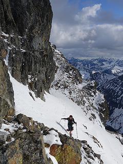
Standing at 10497' elevation, Mount Jefferson is the highest point of Jefferson County & Linn County. This was a great summit trip and is one of my favorite trips of the year. I was accompanied by Josh & Michael. They were each on their "A" games for this trip and I was really impressed. They both have gained so much experience and skill during the past 6-1/2 years I have known them. Everyone on our team was very laid-back and easy-going throughout the trip, and that made the experience even more enjoyable.
We left late Thursday afternoon and fought terrible traffic heading south through Pugetopolis gridlock. In the middle of the night, we eventually reached a Rest Area between Mill City and Detroit. Josh & Michael opted to sleep under the stars... or rather under a tree under the stars. I, on the other hand, opted to lounge back in the comforts of the front seat of my passenger vehicle. I thought the most interesting thing about this Rest Area was that it had a PRINGLES vending machine... I had never seen that before.
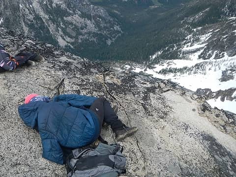
 Whoa!!! Seriously?!?!?! 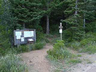 Woodpecker TH 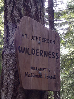 It Just Got Real 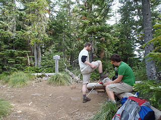 I Can Chop This With My Foot! 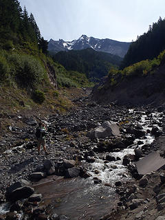 Crossing Milk Creek 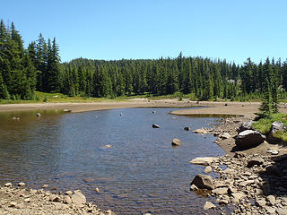 Shale Lake 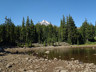 Peak View From Shale Lake 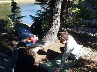 Let's Nap An Hour.. Or Four... 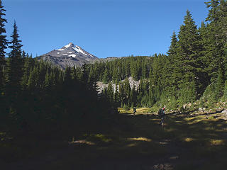 Crossing An Alpine Meadow 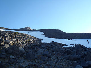 View Of Peak From High Camp 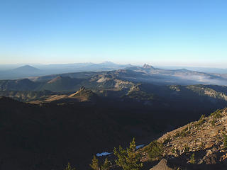 Great Views! 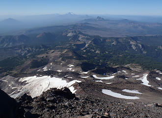 Great View To South 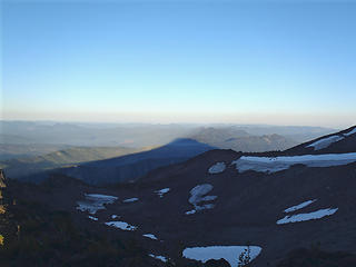 Morning Shadow 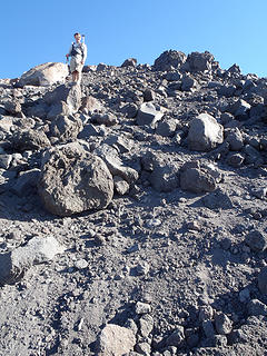 All Smiles On South Ridge 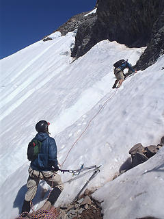 Josh Leads The First Pitch 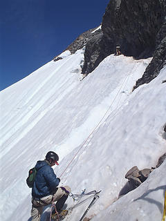 Go, Josh, Go! Moat, Josh, Moat! 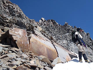 At Rib Beyond West Traverse 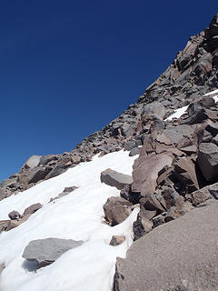 Rounding The Rib... 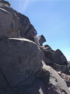 1 label "I expected this to be harder." 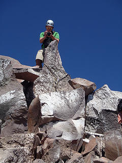 Josh At The Top 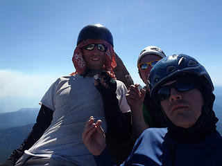 Showing Off Our Jeffersons 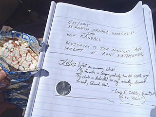 Summit Register 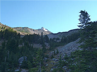 Last Good View Of Peak
60 pounds lighter but not 60 points brighter.
60 pounds lighter but not 60 points brighter.
|
| Back to top |
  
|
|
Josh Journey
a.k.a Josh Lewis
Joined: 01 Nov 2007
Posts: 4836 | TRs | Pics
|
A great trip with a lot of great views.
 P1090701 P1090703 P1090704 P1090707 P1090721 P1090723 P1090725 P1090730 P1090733 P1090737 P1090738 P1090746 P1090748 P1090760 P1090761 P1090767 P1090769 P1090773 P1090777 P1090782 P1090792 P1090794 P1090828 P1090830 P1090836 P1090838 P1090845 P1090847 P1090860 P1090862 P1090863 P1090865 P1090866 P1090868 P1090874 P1090881 P1090885 P1090889 P1090891 P1090895 P1090899 P1090901 P1090902 P1090903 P1090907 P1090908 P1090911 P1090914 P1090916 P1090925 P1090928 P1090931 P1090936 P1090937 P1090941 P1090944 P1090949 P1090950 P1090965 P1090968 P1090972 P1100008
|
| Back to top |
|
|
smmslt
Prominencian

Joined: 14 Jan 2003
Posts: 89 | TRs | Pics
Location: Vancouver, WA |
|
smmslt
Prominencian
|
Tue Jul 21, 2015 5:44 pm |
|
|
Nice going guys, and great photos! Brings back lots of memories.
|
| Back to top |
|
|
DIYSteve
seeking hygge

Joined: 06 Mar 2007
Posts: 12655 | TRs | Pics
Location: here now |
|
DIYSteve
seeking hygge
|
Tue Jul 21, 2015 5:55 pm |
|
|
 Such a cool place, OR's wildest. Good work getting up that PITA Pinnacle. Such a cool place, OR's wildest. Good work getting up that PITA Pinnacle.
|
| Back to top |
|
|
mtn.climber
Member

Joined: 29 Jul 2008
Posts: 1204 | TRs | Pics
Location: The Lost Horizon |
Reach for the sky, cuz tomorrow may never come.
Live the life of love. Love the life you live.
|
| Back to top |
|
|
zephyr
aka friendly hiker

Joined: 21 Jun 2009
Posts: 3370 | TRs | Pics
Location: West Seattle |
|
zephyr
aka friendly hiker
|
Tue Jul 21, 2015 9:56 pm |
|
|
Congratulations! Great work, you three!
That's an excellent report, Redwic. Fine teamwork and leadership. It speaks highly of you that you got up in the middle of the night to advise that other team. Too bad they either missed or ignored you.
Some of those views Josh captured are amazing. Love this action shot and the context. Puts you right there. ~z
| Josh Lewis wrote: | P1090895 |
|
| Back to top |
|
|
Michael Lewis
Taking a nap
Joined: 27 Apr 2009
Posts: 629 | TRs | Pics
Location: Lynnwood, WA (for now) |
Thanks for having us Redwic! It was certainly a memorable trip.
|
| Back to top |
|
|
puzzlr
Mid Fork Rocks

Joined: 13 Feb 2007
Posts: 7220 | TRs | Pics
Location: Stuck in the middle |
|
puzzlr
Mid Fork Rocks
|
Tue Jul 21, 2015 10:51 pm |
|
|
It looks pretty crumbly up there. Good work getting up and down safely.
|
| Back to top |
|
|
|
|
You cannot post new topics in this forum
You cannot reply to topics in this forum
You cannot edit your posts in this forum
You cannot delete your posts in this forum
You cannot vote in polls in this forum
|
Disclosure: As an Amazon Associate NWHikers.net earns from qualifying purchases when you use our link(s). |


