| Previous :: Next Topic |
| Author |
Message |
wildernessed
viewbagger


Joined: 31 Oct 2004
Posts: 9275 | TRs | Pics
Location: Wenatchee |
Location : NE of Peshastin
Access : Derby Canyon Rd. (FR 7400) to around 1500' trail comes down to the road on your left
Maps : TOPO
Stats : 8.8 mi, 3700' loop (our trip using ridge to summit, out via forest road)
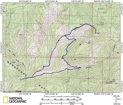 Humility Hill 4358 via Xanadu Ridge  In the past we had all made that mistake going left instead of right on previous trips, but the right is plainly marked 7400 and above all it has a gate. Go through the gate. The map, and landmarks showed us the other problem when we got our elevation there was a ridge between us and Humility Hill so we had to be over there. Once we got started on attempt three the third time was the charm. It was a cascade of mistakes in an area we had driven and hiked many times. I am calling it a "Near Senior Moment".
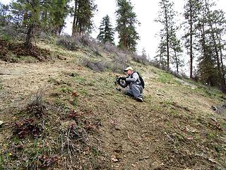
But anyhow, Xanadu Ridge is an expert level mountain bike route which means it's also a hiking route there were quite a variety of wildflowers down low and the Balsam Root were just about ready to bloom, the ridge trail was dry, and we did have expanding views as we gained elevation. The sounds of gun fire and motorcycles filled the air early on, but eventually there was just silence. Around 3900' we started getting into some patches of soft snow which we could circumvent until we turned East and headed up the West ridge to the summit ridge. The snow was soft so we post holed quite a bit with gaiters on, but not enough to warrant snowshoes. Some portions of the summit ridge were walkable. We had lunch and coffee on a coolish summit due to some West winds, but the sun off set some of the chill. Terrific and expansive views. I will probably be back once the wildflowers break out, good exercise, nice terrain, and again great views. You could run a loop up there. We returned the same way but dropped down off the ridge onto a forest road and hiked out with good views most of the way down to Derby Canyon (The way bikes come up to drop into the ridge trails). Good trip. In the past we had all made that mistake going left instead of right on previous trips, but the right is plainly marked 7400 and above all it has a gate. Go through the gate. The map, and landmarks showed us the other problem when we got our elevation there was a ridge between us and Humility Hill so we had to be over there. Once we got started on attempt three the third time was the charm. It was a cascade of mistakes in an area we had driven and hiked many times. I am calling it a "Near Senior Moment".
But anyhow, Xanadu Ridge is an expert level mountain bike route which means it's also a hiking route there were quite a variety of wildflowers down low and the Balsam Root were just about ready to bloom, the ridge trail was dry, and we did have expanding views as we gained elevation. The sounds of gun fire and motorcycles filled the air early on, but eventually there was just silence. Around 3900' we started getting into some patches of soft snow which we could circumvent until we turned East and headed up the West ridge to the summit ridge. The snow was soft so we post holed quite a bit with gaiters on, but not enough to warrant snowshoes. Some portions of the summit ridge were walkable. We had lunch and coffee on a coolish summit due to some West winds, but the sun off set some of the chill. Terrific and expansive views. I will probably be back once the wildflowers break out, good exercise, nice terrain, and again great views. You could run a loop up there. We returned the same way but dropped down off the ridge onto a forest road and hiked out with good views most of the way down to Derby Canyon (The way bikes come up to drop into the ridge trails). Good trip. 
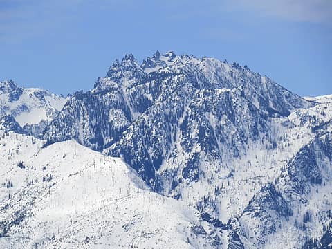 Temple 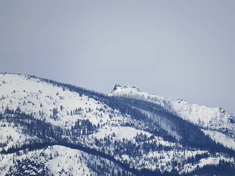 Icicle LO 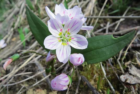 Spring Beauties 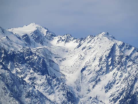 Couloir routes up to Cannon. 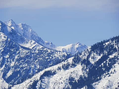 Stuart peeking at us. 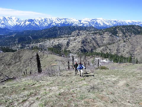 Hit the Trail and Steve grinding out a highpoint on the ridge. 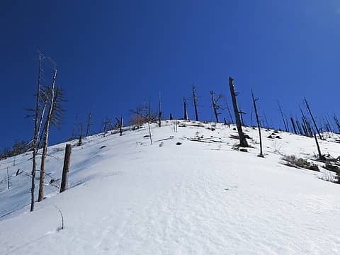 Steepish West ridge the snow was sloppy.  Looking North at Entiat Ridge and Chumsticks. 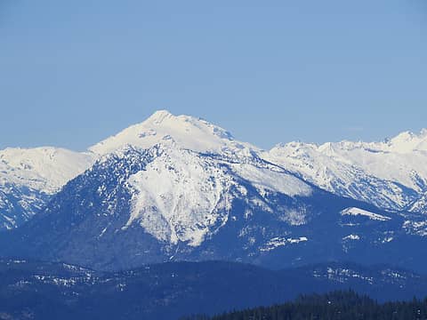 Dirtyface and Glacier. 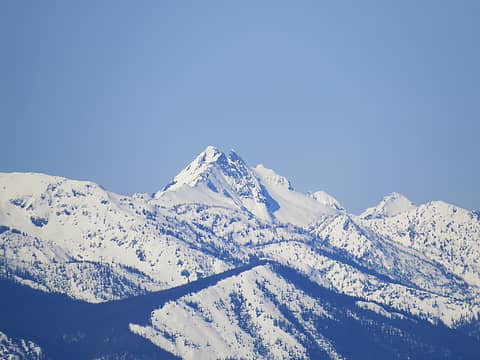 Looks like Bandit from this angle ? 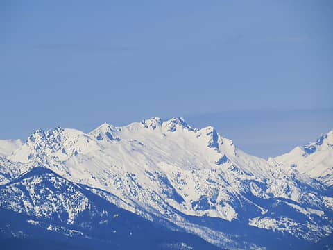 Buck 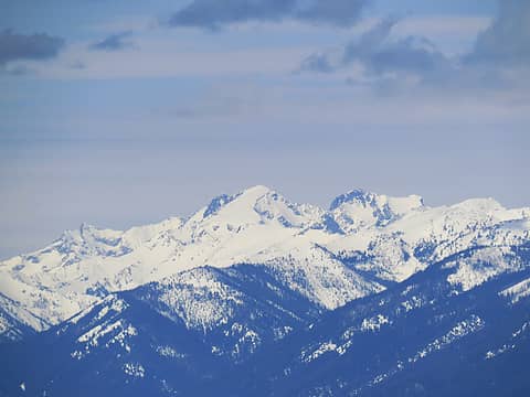 Maude Complex 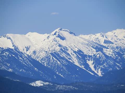 Mt. David 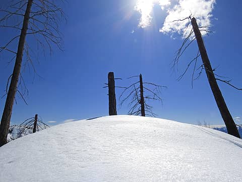 Nearing the summit of Humility Hill from the North side ridge still plenty of snow. 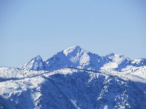 Cashmere 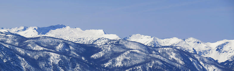 Big Chiwaukum and... 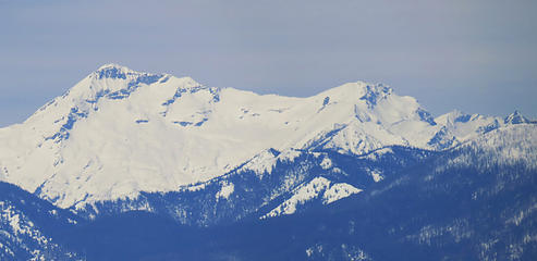 Fortress and Chiwawa 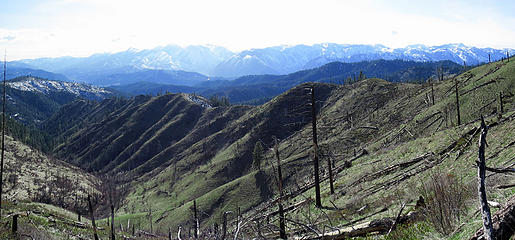 Most of Xanadu Ridge 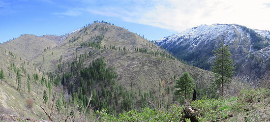 On Xanadu Ridge looking across the canyon at Humility Hill's lower ridge and Blag MOuntain to the right. 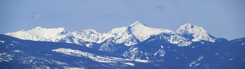 Rock - Howard - Mastiff
Living in the Anthropocene
Living in the Anthropocene
|
| Back to top |
  
|
|
HitTheTrail
Member

Joined: 30 Oct 2007
Posts: 5462 | TRs | Pics
Location: 509 |
This the first time I have I gotten a days worth of exercise before finally getting to the main hike. Then I started having a foot problem not too far below the summit so I let Wildernessed escort Steve on up to the top while I ate lunch. I am starting to listen more to what my body is trying to tell me and I had already been to the summit just a few months earlier anyway. But I had a most enjoyable lunch with expansive views. Not a problem at all in my books. Another good trip guys!
 Destractions right out of the gate 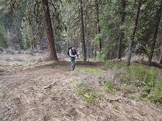 Distractions on the bike trail 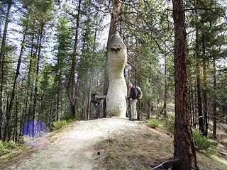 Trail marker 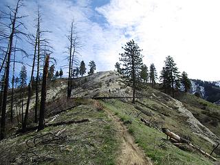 Heading up the bike path 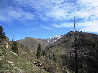 Snow on our destrination 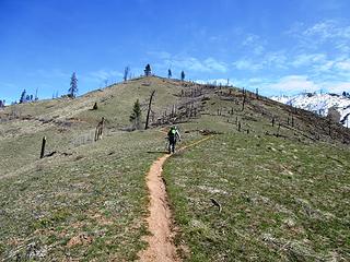 Easy route finding
|
| Back to top |
|
|
RichP
Member

Joined: 13 Jul 2006
Posts: 5634 | TRs | Pics
Location: here |
|
RichP
Member
|
 Sun Mar 27, 2016 4:28 pm |
|
|
| HitTheTrail wrote: | Trail marker |
So much could be said about this photo 
|
| Back to top |
|
|
Distel32
Member

Joined: 03 Jun 2014
Posts: 961 | TRs | Pics
Location: Edmonds, WA |
|
Distel32
Member
|
Sun Mar 27, 2016 4:44 pm |
|
|
Nice pix
|
| Back to top |
|
|
wildernessed
viewbagger
Joined: 31 Oct 2004
Posts: 9275 | TRs | Pics
Location: Wenatchee |
| RichP wrote: | | HitTheTrail wrote: | Trail marker |
So much could be said about this photo |
Plutocracy Rock
Living in the Anthropocene
Living in the Anthropocene
|
| Back to top |
|
|
wildernessed
viewbagger
Joined: 31 Oct 2004
Posts: 9275 | TRs | Pics
Location: Wenatchee |
A year ago today no snow until 3900' plus.  
Living in the Anthropocene
Living in the Anthropocene
|
| Back to top |
|
|
fourteen410
Member

Joined: 23 May 2008
Posts: 2630 | TRs | Pics
|
Was thinking about doing this one last weekend, but figured there'd be lingering snow.
I think I'll save it for when the gold starts popping ;-)
|
| Back to top |
|
|
Brushbuffalo
Member

Joined: 17 Sep 2015
Posts: 1887 | TRs | Pics
Location: there earlier, here now, somewhere later... Bellingham in between |
| wildernessed wrote: | | Once we got started on attempt three the third time was the charm. It was a cascade of mistakes in an area we had driven and hiked many times. I am calling it a "Near Senior Moment". |
I hear ya! This is why I too often these days don't achieve the intended goal on the first try..... 
Passing rocks and trees like they were standing still
Passing rocks and trees like they were standing still
|
| Back to top |
|
|
wildernessed
viewbagger
Joined: 31 Oct 2004
Posts: 9275 | TRs | Pics
Location: Wenatchee |
The section of snow free Ridge is above 4000'. Right now farther East a 3900' fully exposed Pitcher Mountain is snow covered. 
Living in the Anthropocene
Living in the Anthropocene
|
| Back to top |
|
|
wildernessed
viewbagger
Joined: 31 Oct 2004
Posts: 9275 | TRs | Pics
Location: Wenatchee |
| fourteen410 wrote: | | Was thinking about doing this one last weekend, but figured there'd be lingering snow.
I think I'll save it for when the gold starts popping ;-) |
Xanadu is paralled by another nice ridge we did that bikers call Tres Hombres which had a massive amount of wildflowers last year.
Living in the Anthropocene
Living in the Anthropocene
|
| Back to top |
|
|
cartman
Member
Joined: 20 Feb 2007
Posts: 2800 | TRs | Pics
Location: Fremont |
|
cartman
Member
|
Tue Mar 28, 2017 3:54 pm |
|
|
Nice dry hike. So what are the actual miles & gain if doing the loop correctly without the false starts?
|
| Back to top |
|
|
wildernessed
viewbagger
Joined: 31 Oct 2004
Posts: 9275 | TRs | Pics
Location: Wenatchee |
| cartman wrote: | | Nice dry hike. So what are the actual miles & gain if doing the loop correctly without the false starts? |
Those are the adjusted stats. On the Ridge coming up to Humility Hill I did see a trail heading NE and I imagine it leads over to Entiat Ridge and Chumstick. That would be a nice thru hike Derby Canyon to the SR 97 or possibly Anderson Canyon to SR 97.
Living in the Anthropocene
Living in the Anthropocene
|
| Back to top |
|
|
|
|


