| Previous :: Next Topic |
| Author |
Message |
Matt
Tea, Earl Grey, Hot


Joined: 30 Jan 2007
Posts: 4308 | TRs | Pics
Location: Shoreline |
|
Matt
Tea, Earl Grey, Hot
|
 Sat May 21, 2016 5:24 pm |
|
|
Dates: April 30 May 1, 2016
Destinations: Delancy Ridge (7228ft, 768P), Delancy East (6991ft, 411P), Flagg (7422ft, 722P), Catleap (7789ft, 649P)
Party: Matt, Dicey, Cartman, PeakJunkie
This was my third visit to Delancy Ridge, all by approaching straight up from the highway about seven miles east of Washington Pass.
- On April 15, 1999, I went to Delancy Benchmark with a very fast group (mtnmike, Stefan, Mitch Blanton, Greg Koenig), but rested there while they went on to Flagg, because I was saving my energy for a visit to Robinson the next day.
- On May 11, 2014, I went over Delancy Benchmark to Flagg Mtn with Yana & GeoTom on a beautiful day of gathering clouds and bold sunlight.
- This time we wanted to celebrate the opening of SR20 by camping up high on the ridge and visiting more of the surrounding peaks, especially the rarely visited Catleap.
Itinerary
Saturday: We hiked up the south slope of Delancy Ridge and made camp atop Point 6686. Then we divided for side trips east along Delancy Ridge and west to Flagg Mtn.
Sunday: We made a morning side trip to Catleap Peak, then hiked back down to the highway.
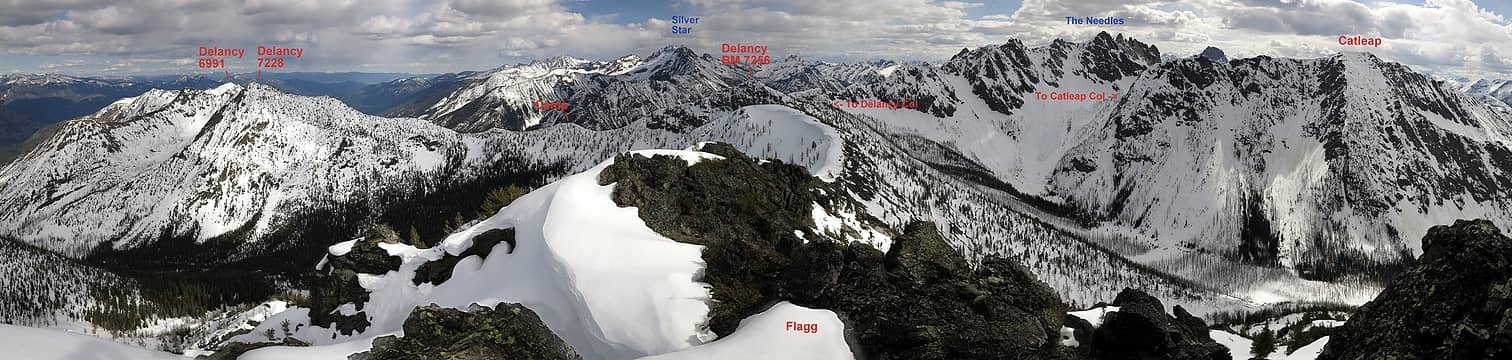 The peaks of this trip, as viewed from Flagg Mtn in 2014 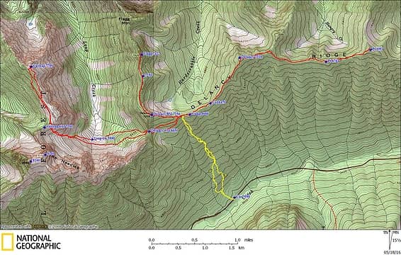 GPS Track 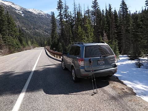 Our "trailhead" 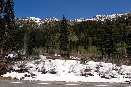 Go into woods left of this photo to avoid brush, then angle back up the open meadows and forests 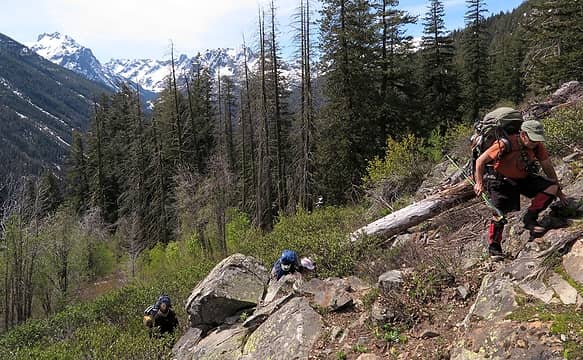 Ascending the steep mix of forest, brush & rock 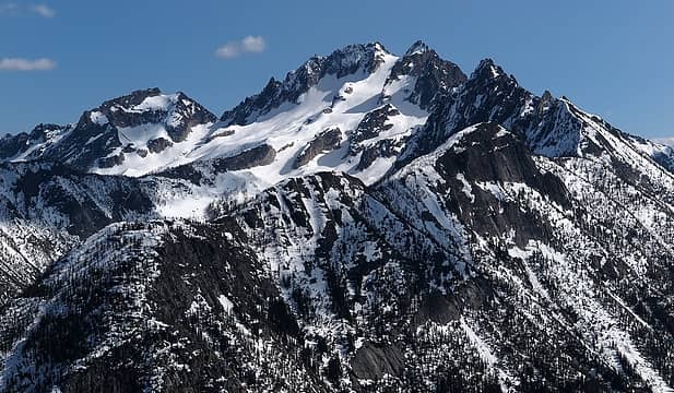 Silver Star across the valley 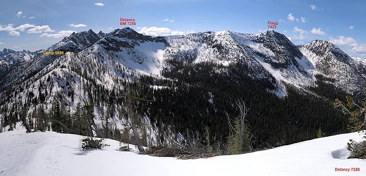 Camp, Delancy BM & Flagg, as viewed from Delancy 7228 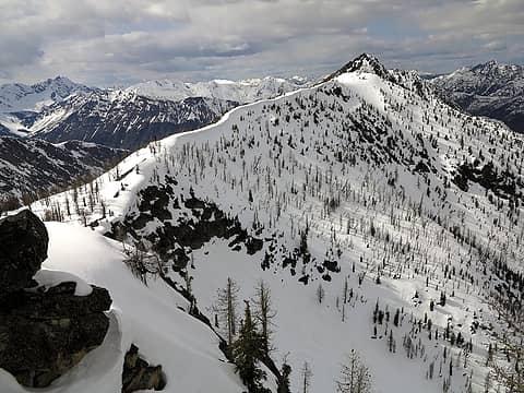 Looking from Delancy BM to Flagg, May 2014 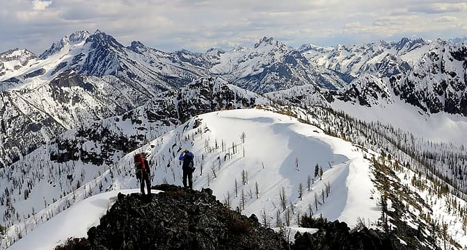 Yana & GeoTom enjoying the view from Flagg, May 2014 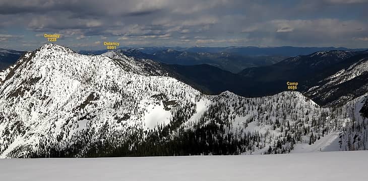 Delancy ridge as viewed from Flagg Mtn in May 2014 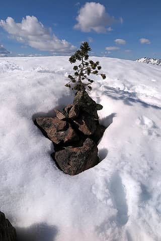 Delancy Ridge summit cairn 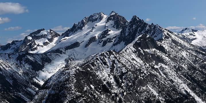 A more eastern angle on Silver Moon & Silver Star, rising above Silver Star Creek 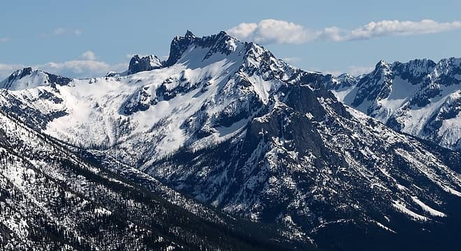 Kangaroo Ridge 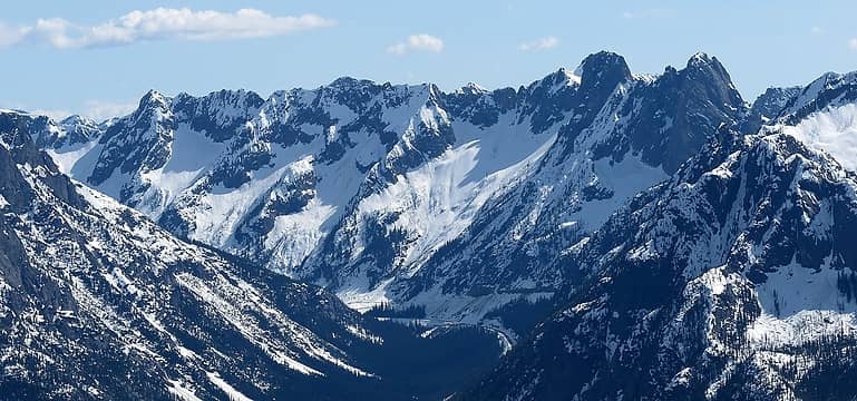 Early Winters ridge rising above the Washington Pass hairpin 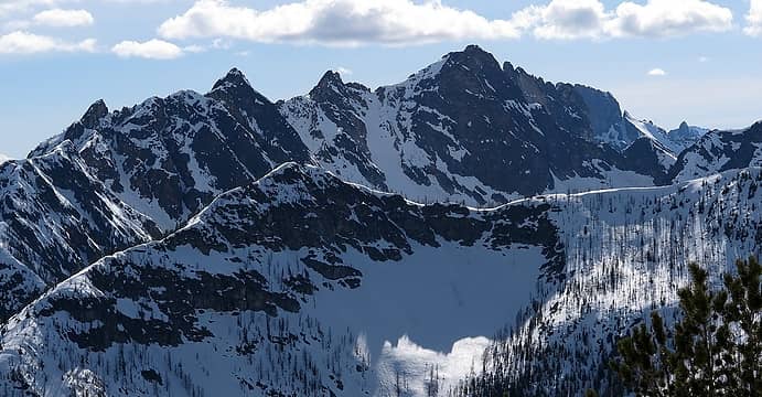 The Needles rising above Delancy Benchmark 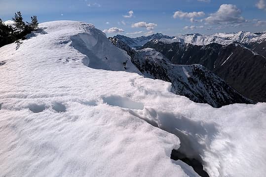 Failing cornices on Delancy Ridge 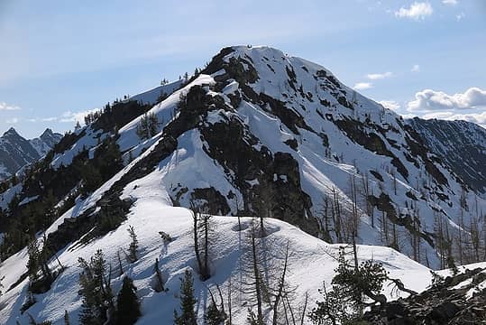 Looking back up at the west ridge of Delancy 7228 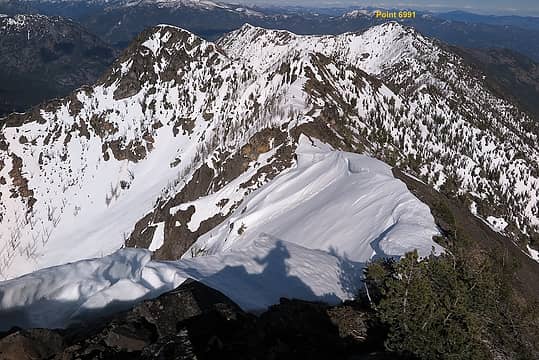 Looking ahead along the undulating ridge to East Delancy 6991 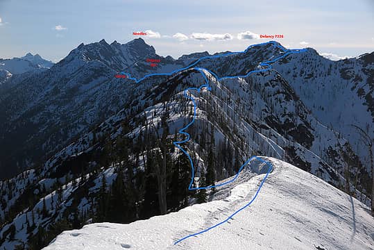 Looking back across all the ups and downs to camp 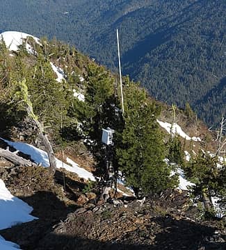 Repeater just past East Delancy 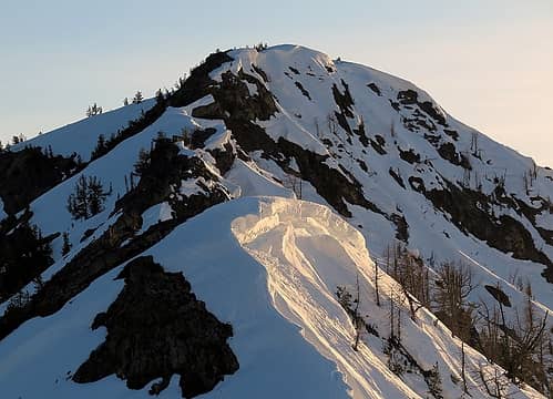 Sidelit cornices glowing from below 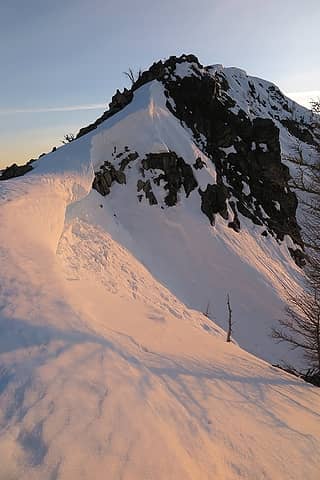 Cornices turning pink 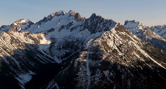 Silver Star afternoon light, 7:17pm 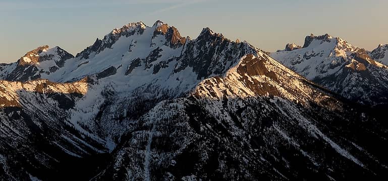 Silver Star golden light, 7:47pm 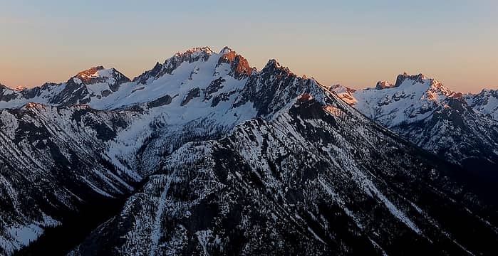 Silver Star alpenglow, 8:07pm 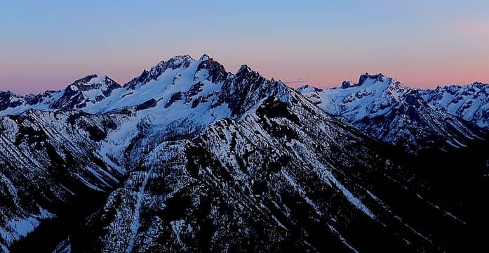 Silver Star afterglow, 8:14pm 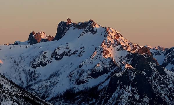 Big Kangaroo 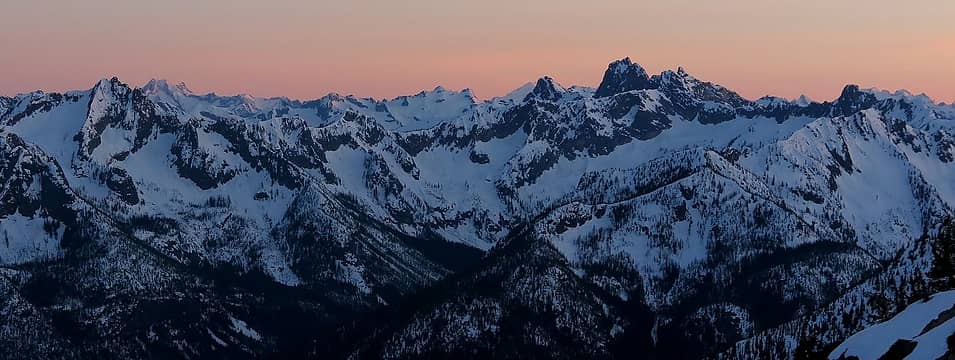 6 labels The Cutthroat crest form Hinkhouse to Cutthroat to Molar Tooth (with bits of Bonanza, Glacier, & Dome in the background) 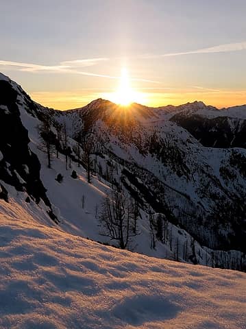 Sunset burning through Azurite (note that summit spires are entirely missing) 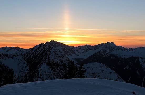 Solar pillar just after sunset 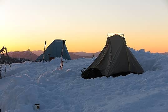 dawn approaches the sleeping camp 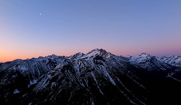 Foreglow behind Silver Star, 5:37am 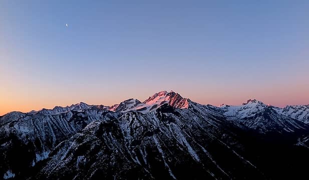 First alpenglow on Silver Star, 5:44am 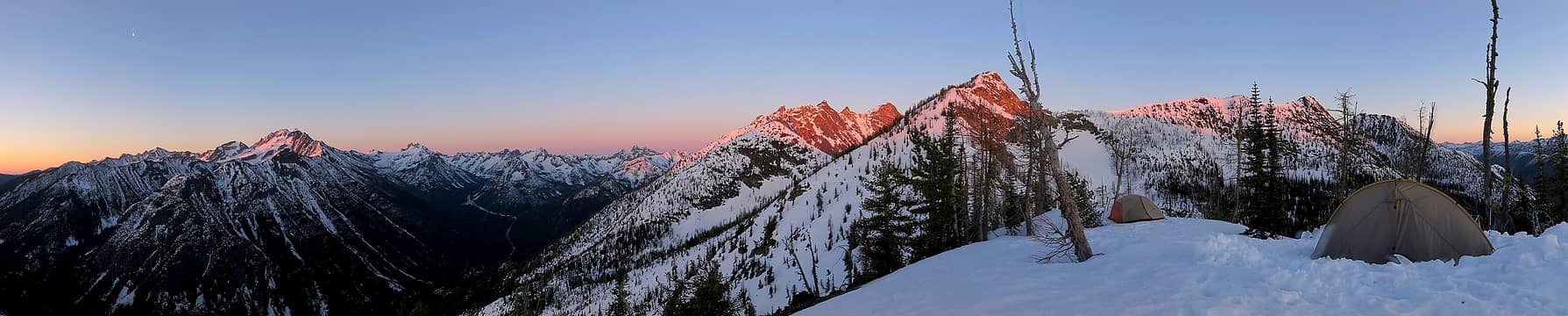 Peaks rising up into the morning light 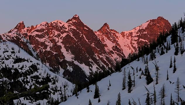 Alpenglow on the Needles 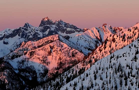 Pinkthroat 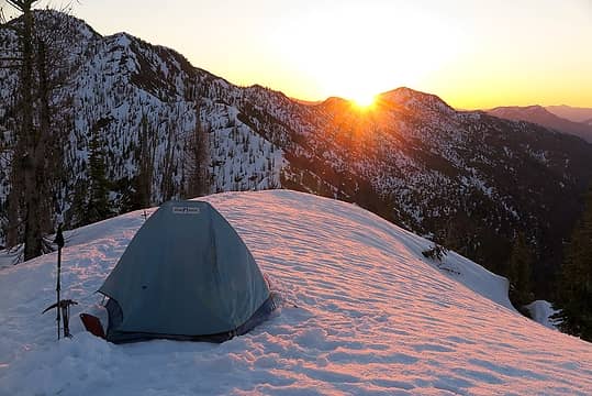 Sunrise burns through East Delancy 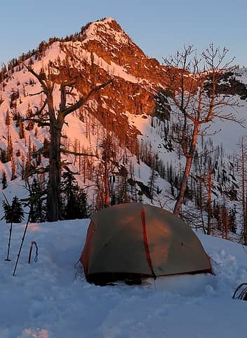 Sunrise reaches my tent below Delancy Benchmark - A half-mile short traverse to Delancy Col, the 6650-foot col between Delancy & The Needles.
- An almost-two-mile curve down the wide headwater basin of Leap Creek below the Needles and then back up to Catleap Col, the 7140-foot col between Needles & Catleap.
- A mile-long traverse along the west slope of Catleap up to its summit at 7789.
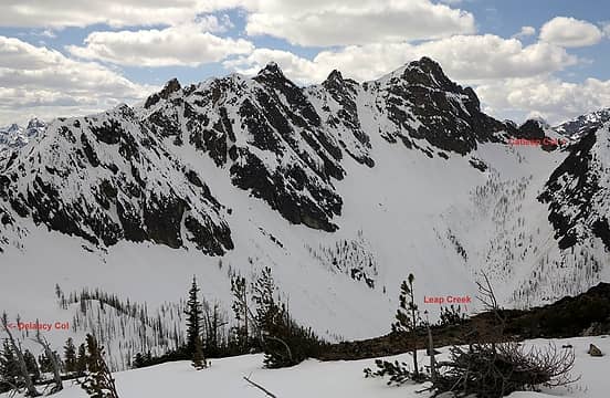 The traverse from Delancy Col to Catleap Col, viewed from Delancy Benchmark 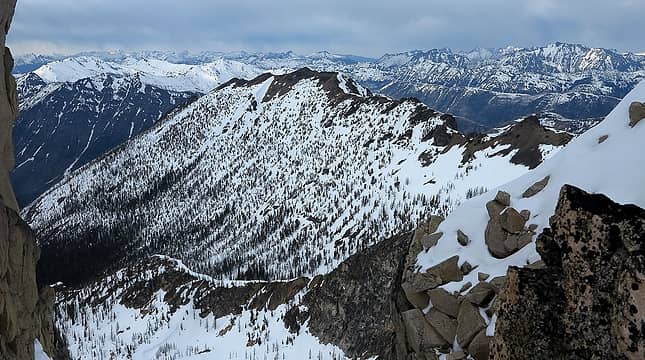 The west slope of Catleap, viewed from The Needles 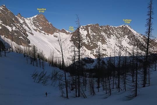 Descending into Leap Creek Basin 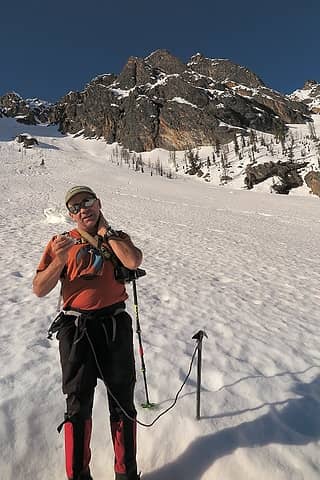 peakjunkie adding some sunscreen in the warm sunny basin 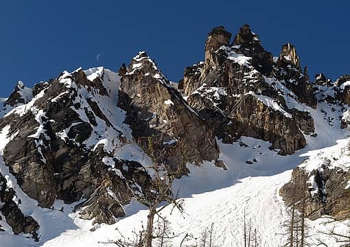 Moon skimming the crest of The Needles 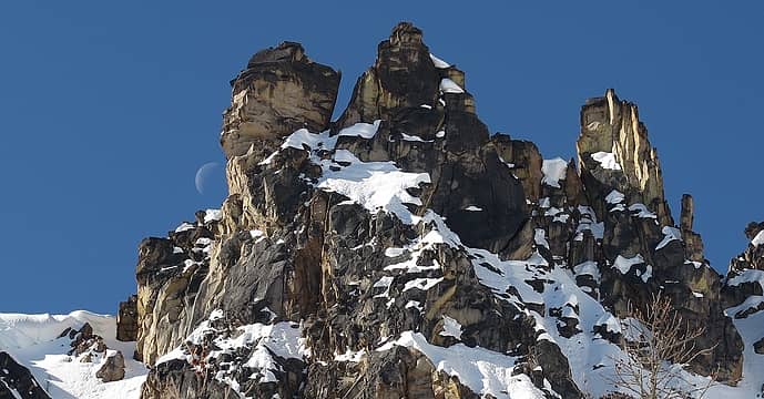 Pac-Man Moon about to take a bite out of some spires 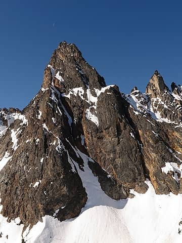 Moon above the false summit of The Needles 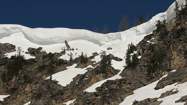 The cornice wall blocking Catleap Col 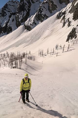 1 label Bright lemony Dicey coming up out of the basin 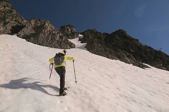 Heading up to the escape gully 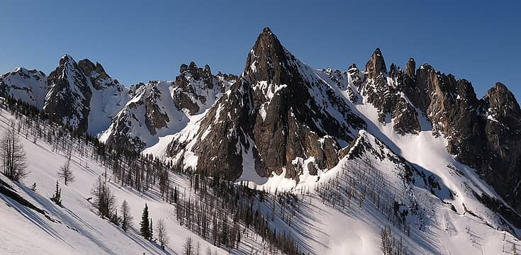 The Needles standing above the north side of Catleap Col 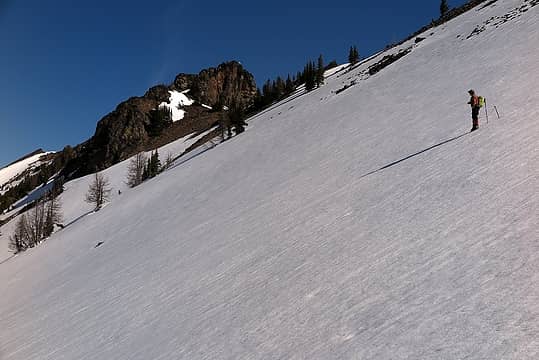 Anticipating the long sidehill to Catleap's summit 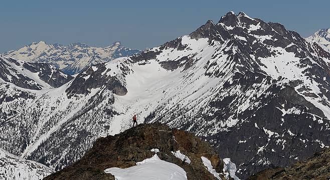 peakjunkie standing at the far end of Catleap, with Pickets and Azurite beyond. 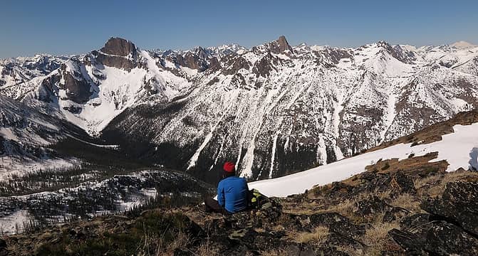 peakjunkie soaking up the view of Tower, Golden, Horn & Straight Ridge 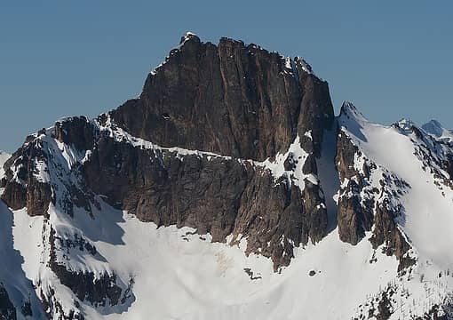 1 label Northeast face of Tower (the face route actually follows that snowy ledge halfway across the peak) (also, you can see the summit cairn from 3 miles away) 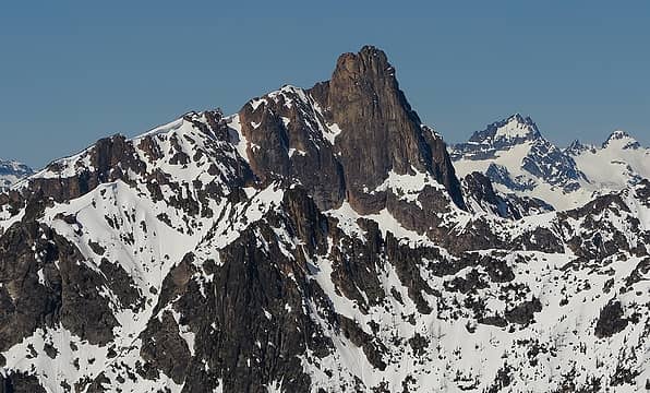 Golden Horn 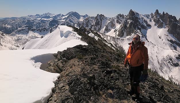 Me on Catleap 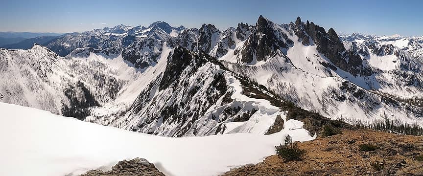 3 labels Wide view southward along the crest of Catleap 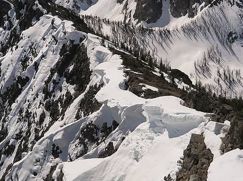 Collapsing Cornices of Catleap 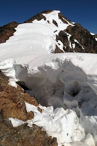 Back side of the cornices 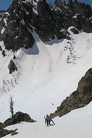 Descending the gully 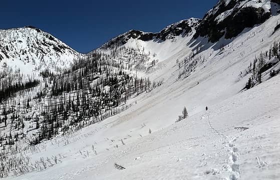 peakjunkie traversing back across Leap Creek basin 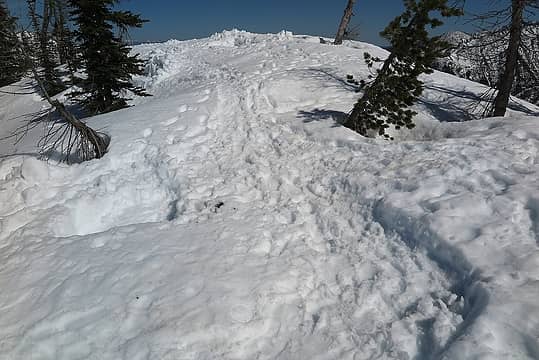 The empty foundations of our campsite and kitchen area
As beacons mountains burned at evening. J.R.R. Tolkien
As beacons mountains burned at evening. J.R.R. Tolkien
|
| Back to top |
  
|
|
RichP
Member

Joined: 13 Jul 2006
Posts: 5634 | TRs | Pics
Location: here |
|
RichP
Member
|
Sat May 21, 2016 5:53 pm |
|
|
Awesome trip. Those great weather days seem so far away now. 
|
| Back to top |
|
|
Nancyann
Member

Joined: 28 Jul 2013
Posts: 2322 | TRs | Pics
Location: Sultan Basin |
|
Nancyann
Member
|
Sat May 21, 2016 9:48 pm |
|
|
More great work from the "demented groundhog". Matt, thank you so much for taking the time to share your magnificent photos and stories. Many (most) of us would never get to see these incredible views if it weren't for you.
|
| Back to top |
|
|
Jetlag
Member
Joined: 17 Aug 2010
Posts: 1410 | TRs | Pics
|
|
Jetlag
Member
|
Sun May 22, 2016 9:15 am |
|
|
Wow! Those are beautiful views. Particularly like the perspective on Silver Star and The Needles!
|
| Back to top |
|
|
wildernessed
viewbagger

Joined: 31 Oct 2004
Posts: 9275 | TRs | Pics
Location: Wenatchee |
 Nice. I had thought that point would make a better destination if you went in from the Driveway Butte trail instead of going over to Driveway Butte. Great views, pics, and route. Nice. I had thought that point would make a better destination if you went in from the Driveway Butte trail instead of going over to Driveway Butte. Great views, pics, and route.
Living in the Anthropocene
Living in the Anthropocene
|
| Back to top |
|
|
Stefan-K
Member

Joined: 10 Aug 2009
Posts: 522 | TRs | Pics
Location: seattle |
|
Stefan-K
Member
|
Sun May 22, 2016 10:18 am |
|
|
some really nice seldom seen perspectives from there... thanks for the report Matt. I bet the temptation of skis crossed the minds of at least half the group...
|
| Back to top |
|
|
Matt
Tea, Earl Grey, Hot
Joined: 30 Jan 2007
Posts: 4308 | TRs | Pics
Location: Shoreline |
|
Matt
Tea, Earl Grey, Hot
|
Sun May 22, 2016 10:30 am |
|
|
| Stefan-K wrote: | | the temptation of skis |
We found traces of ski tracks everywhere we went on Delancy Ridge, from Point 6991 to Delancy Benchmark and down the route that we came up. I suspect they traversed the entire ridge.
As beacons mountains burned at evening. J.R.R. Tolkien
As beacons mountains burned at evening. J.R.R. Tolkien
|
| Back to top |
|
|
Gimpilator
infinity/21M

Joined: 12 Oct 2006
Posts: 1684 | TRs | Pics
Location: Edmonds, WA |
Sweet trip! Thanks for the report. Do you feel that this route is better with some snow in early season or is that not an important factor? I have considered Delancy Ridge before because it seems like a superb place to view The Needles as your photos confirm.
|
| Back to top |
|
|
Matt
Tea, Earl Grey, Hot
Joined: 30 Jan 2007
Posts: 4308 | TRs | Pics
Location: Shoreline |
|
Matt
Tea, Earl Grey, Hot
|
Sun May 22, 2016 11:58 am |
|
|
I think it's easier on snow, because there'd be a lot more brush and talus later.
However, that basin below The Needles is almost entirely larch trees, so it would also be beautiful in early October.
As beacons mountains burned at evening. J.R.R. Tolkien
As beacons mountains burned at evening. J.R.R. Tolkien
|
| Back to top |
|
|
Distel32
Member
Joined: 03 Jun 2014
Posts: 961 | TRs | Pics
Location: Edmonds, WA |
|
Distel32
Member
|
Sun May 22, 2016 1:28 pm |
|
|
|
| Back to top |
|
|
GaliWalker
Have camera will use

Joined: 10 Dec 2007
Posts: 4931 | TRs | Pics
Location: Pittsburgh |
|
GaliWalker
Have camera will use
|
Fri May 27, 2016 1:46 pm |
|
|
| Matt wrote: | | The long days of spring give lots of time for hiking, but not so much for sleeping. I'd gotten in late last night, but by 5:30am the clear skies were beginning to glow with pastel light, so sleep became an expendable luxury.
...
A sickle moon hung high above Silver Star as morning light descended onto the heights. |
Nice.
|
| Back to top |
|
|
|
|
You cannot post new topics in this forum
You cannot reply to topics in this forum
You cannot edit your posts in this forum
You cannot delete your posts in this forum
You cannot vote in polls in this forum
|
Disclosure: As an Amazon Associate NWHikers.net earns from qualifying purchases when you use our link(s). |


