| Previous :: Next Topic |
| Author |
Message |
meck
Member


Joined: 31 Dec 2010
Posts: 920 | TRs | Pics
|
|
meck
Member
|
 Mon Apr 17, 2017 10:40 pm |
|
|
Wolf Creek Trail, ONP 16 April 2017
Price of fuel: ~$25
Price of Snacks: ~$10
Car Time: ~4 hours RT
Having all of Hurricane Ridge to yourself: priceless!
The Wolf Creek Trail heads up to the Hurricane Hill Road from the Whiskey Bend TH along the Elwha. It is an old converted Service Road and gains about 3900' in 8 miles.
First significant snow patch started around 3500' (about 500 yards), and then became continuous around 3800'. I used snowshoes from there, all the way up and then back.
I got a late start around noon from Whiskey Bend, made it to the Hurricane Hill road, and then on to the Visitor Center lodge by ~1610. I had a snack in the snow in front of the "Bailey Range" webcam, signed the visitor book, and then wandered on back down the road/trail, arriving back at the TH by 2000.
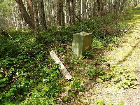 several transformers along side the trail on the way up. 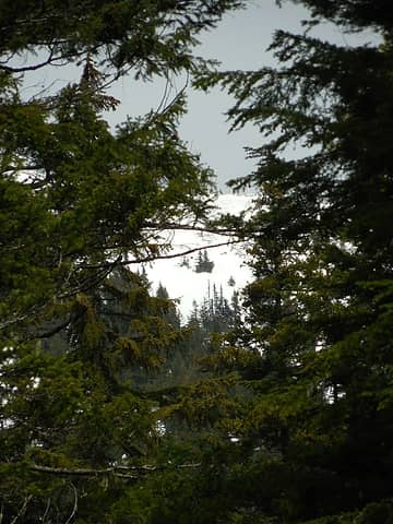 looking up to the ridge line 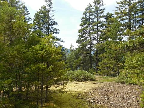 one of several switchbacks on the way up (a couple of them would make for nice camps... aside from no easy access water source) 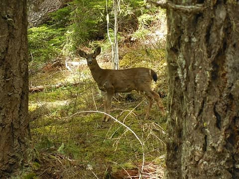 Hey there Easter deer! 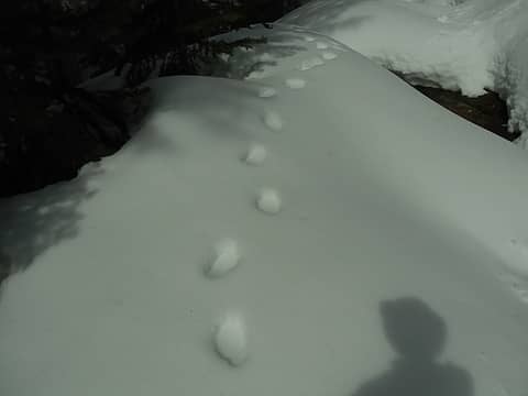 Bear Tracks 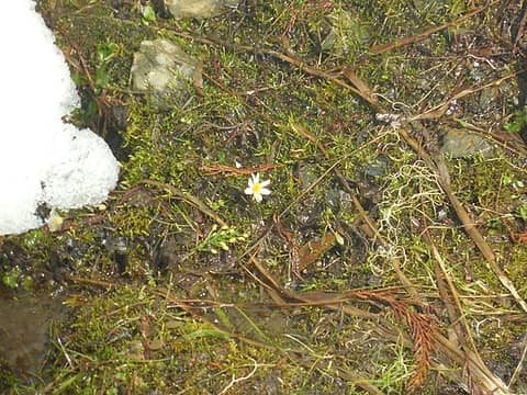 First spring flower in the snow 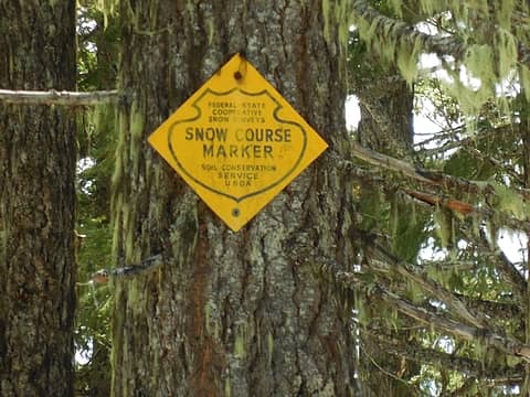 nearing the top 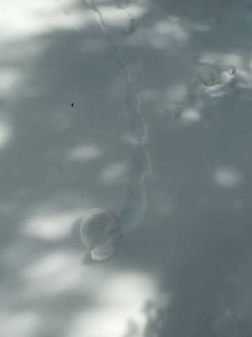 snow pinwheel 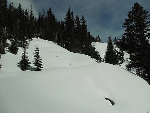 more views opening up 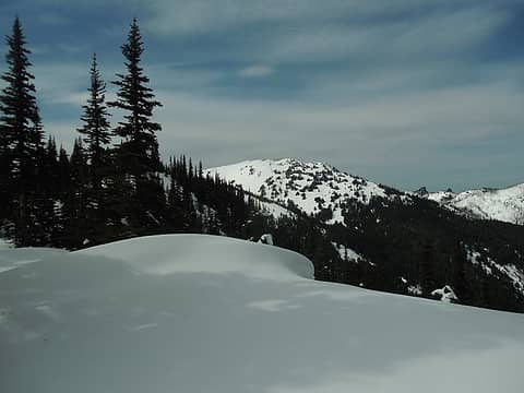 Hurricane Hill, Griff and Unicorn (or maybe only Unicorn and Unicorn Horn?) 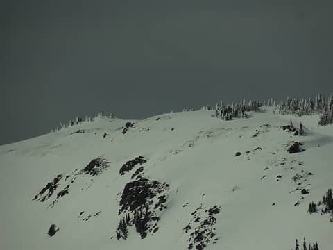 Hurricane Hill 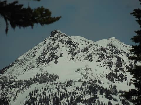 Mt Angeles to the east 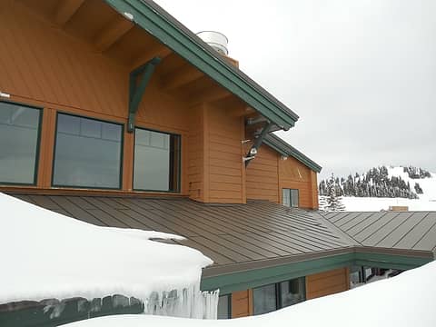 smile for the camera 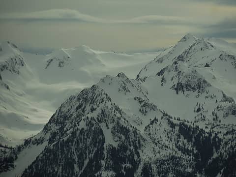 sunny highlights 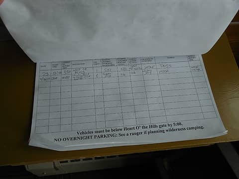 sign in for my visit 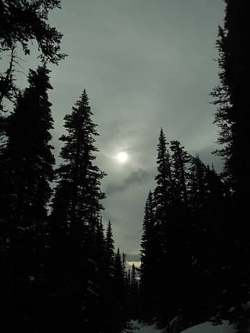 sunny spot in the clouds 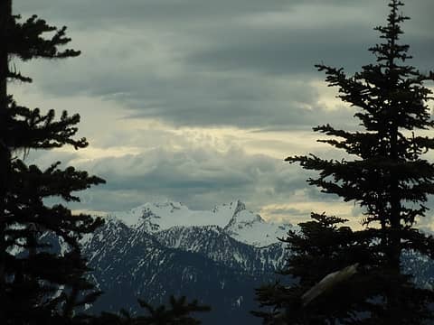 interesting clouds over Pt 6100 (r) and Mt. Appleton (l)
*Just say NO to Rent-Seeking, don't give up the concept of "ownership"*
*Just say NO to Rent-Seeking, don't give up the concept of "ownership"*
|
| Back to top |
  
|
|
fourteen410
Member

Joined: 23 May 2008
Posts: 2629 | TRs | Pics
|
 I've always wondered about that trail. thx for sharing. I've always wondered about that trail. thx for sharing.
|
| Back to top |
|
|
Distel32
Member
Joined: 03 Jun 2014
Posts: 961 | TRs | Pics
Location: Edmonds, WA |
|
Distel32
Member
|
Tue Apr 18, 2017 6:41 am |
|
|
|
| Back to top |
|
|
silence
Member

Joined: 25 Apr 2005
Posts: 4420 | TRs | Pics
|
|
silence
Member
|
Tue Apr 18, 2017 6:55 am |
|
|
Very nice report! Thx for posting.
PHOTOS
FILMS
Keep a good head and always carry a light bulb. Bob Dylan
PHOTOS
FILMS
Keep a good head and always carry a light bulb. Bob Dylan
|
| Back to top |
|
|
RodF
Member

Joined: 01 Sep 2007
Posts: 2593 | TRs | Pics
Location: Sequim WA |
|
RodF
Member
|
Thu Apr 20, 2017 1:33 am |
|
|
Well done! Thanks for sharing, Meck.
| meck wrote: | one of several switchbacks on the way up (a couple of them would make for nice camps... aside from no easy access water source) |
Indeed, one was! I think that meadow was the roadside picnic area (built by Civilian Conservation Corps ca. 1934) overlooked by Idaho Camp Shelter (built trailside by USFS ca. 1930 before the CCC road).
I think the green metal roadside boxes were simply junction boxes (not transformers) where they spliced on the next spool when laying the underground powerline to the Visitors Center ca. 1953.
"of all the paths you take in life, make sure a few of them are dirt" - John Muir
"the wild is not the opposite of cultivated. It is the opposite of the captivated - Vandana Shiva
"of all the paths you take in life, make sure a few of them are dirt" - John Muir
"the wild is not the opposite of cultivated. It is the opposite of the captivated - Vandana Shiva
|
| Back to top |
|
|
meck
Member
Joined: 31 Dec 2010
Posts: 920 | TRs | Pics
|
|
meck
Member
|
Thu Apr 20, 2017 5:33 pm |
|
|
Thanks all for giving this a read.
@hesman: That must have a been a long day, but yeah that downhill road/trail stretch would be a good "zone-out" section! I'd been considering that loop later this summer to "bag" this trail but opted to just go for this trail last Sunday to keep working towards my goal. I've only got one more trail left to hike in the Elwha drainage now (5 mile primitive from Dodger Pt down to the Elwha), and only three more trails/sections on the north side of the ONP/ONF to hike (Little River, the 0.5 mile spur down to Happy Lake, and the 1 mile stretch between Lizard Head Peak and Happy Lake Ride). All the rest of the trails that I've got left to hike in ONP/ONF are the west side river trails (Bogie, Hoh/S.Hoh, Queets, Humptulips), a few trails on the south end (Elip Creek, short loop hikes on Lake Quinalt & Fletcher Canyon, Graves Creek tr, Six Ridge, Colonel Bob) and the Lost/Cameron Pass and LaCrosse Pass trails.
@RodF: That makes a lot of sense given the nice terrain. A few of the corners were wider than I'd expected (even for an old mountain road), and had some pretty amazing views. The junction box thing makes more sense too given the shape and overall size (and the distinct lack of a "hum"... though without a significant electrical load maybe it would not hum much). Is that still the Visitor Center's power path? (I've noticed a few vault boxes on the main HR road too) If so, I would think that bodes well for keeping the Whiskey Bend road open/maintained in the future. Every time I drive that road I wonder if it will be the last given how many spots look like they could wash out catastrophically.
*Just say NO to Rent-Seeking, don't give up the concept of "ownership"*
*Just say NO to Rent-Seeking, don't give up the concept of "ownership"*
|
| Back to top |
|
|
yorknl
Member
Joined: 04 Aug 2008
Posts: 136 | TRs | Pics
|
|
yorknl
Member
|
Thu Apr 20, 2017 9:06 pm |
|
|
Very cool. And if I'd ever stopped to wonder what the Kloshe Nanich / North Point road would look like ten years after closure, that mystery would have just been answered.
|
| Back to top |
|
|
RodF
Member
Joined: 01 Sep 2007
Posts: 2593 | TRs | Pics
Location: Sequim WA |
|
RodF
Member
|
Tue Apr 25, 2017 3:36 pm |
|
|
| meck wrote: | | Is that still the Visitor Center's power path? |
Nope, the new underground powerline is beneath the outer shoulder of Hurricane Ridge Road
"The initial phase of this project, trenching and installation of 4 ea. 2-inch diameter schedule 40 PVC electrical conduit, with junction boxes and grounding rods the full length of the 12.5-mile Hurricane Ridge Road, was completed as part of the Hurricane Ridge Road construction project." I think that was 2009 ARRA funding, and done in 2010 and 2011.
"This project consists of installing 12.5 miles of single-phase electrical conductor in the completed conduit.
"The new line will replace 8.1 miles of aging jacketed single-phase direct burial electrical cable that extends through designated wilderness plus 4.5 miles of cable along the Whiskey Bend Road from the Elwha Ranger Station."
The old line was abandoned. I think that was in 2012.
"of all the paths you take in life, make sure a few of them are dirt" - John Muir
"the wild is not the opposite of cultivated. It is the opposite of the captivated - Vandana Shiva
"of all the paths you take in life, make sure a few of them are dirt" - John Muir
"the wild is not the opposite of cultivated. It is the opposite of the captivated - Vandana Shiva
|
| Back to top |
|
|
|
|
You cannot post new topics in this forum
You cannot reply to topics in this forum
You cannot edit your posts in this forum
You cannot delete your posts in this forum
You cannot vote in polls in this forum
|
Disclosure: As an Amazon Associate NWHikers.net earns from qualifying purchases when you use our link(s). |


