| Previous :: Next Topic |
| Author |
Message |
Double_E
Member


Joined: 21 Jul 2005
Posts: 36 | TRs | Pics
Location: Seattle |
|
Double_E
Member
|
 Sun Sep 24, 2017 1:26 pm |
|
|
Decided to take advantage of late summer low stream flows to do the Elwha -> Remanns cabin ford -> Dodger Point loop Id been wanting to do. The trail conditions page on the park website said the ford was manageagle so I figured it was time to hit it.
The first day, I hiked the ~11 miles from Whiskey Bend up to Elkhorn. Good lord the Elwha valley is gorgeous; srsly one of my favorite parts of Cascadia. I'd been up to Lillian Camp in recent history, but hadn't been beyond that in the Elwha since I did the NF Quinault to Whiskey Bend through-hike in the mid 90s.
All told, only saw 9 people over the 11 miles to get to Elkhorn.
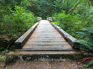 Cool little bridge, Elwha River trail 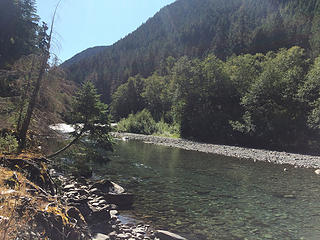 Elwha River, about a mile north of Mary's Falls camp 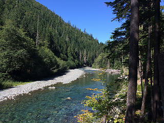 Elwha River, about a mile north of Mary's Falls camp 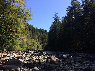 Elwha River, Canyon camp 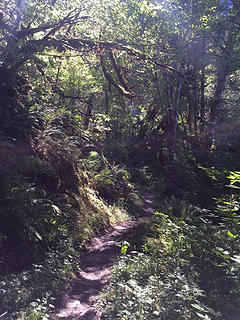 Elwha River trail 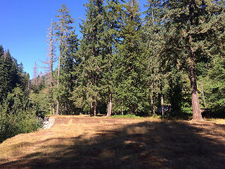 Elkhorn camp 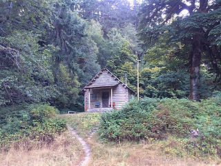 Elkhorn ranger cabin 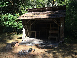 Elkhorn shelter 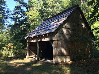 Elkhorn "barn" 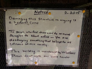 Sign at Elkhorn barn... amazing that they actually have to post this stuff, 11 miles in 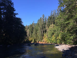 Elwha River at Elkhorn camp 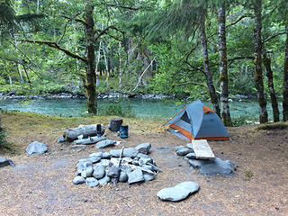 Elkhorn camp 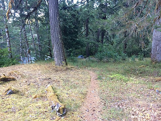 Elkhorn camp 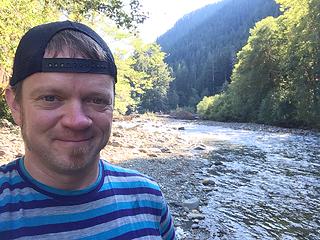 Elwha River, Elkhorn camp 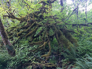 Mass of mossy maples 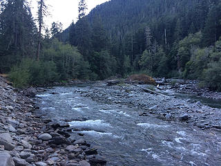 Elwha River 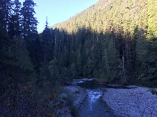 Elwha River, just before getting to Remann's cabin 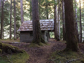 Remann's cabin 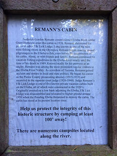 Remann's cabin 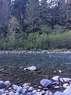 Ford at Remann's cabin ... was deeper than it looks here; almost waist deep! 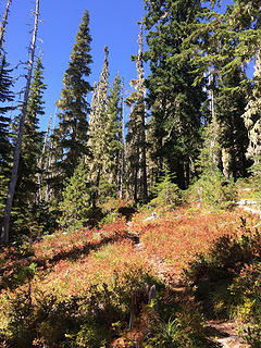 Primitive trail from Elwha to Dodger Point 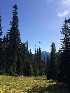 Primitive trail from Elwha to Dodger Point 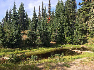 Tiny pond, near the intersection with the waytrail to Ludden Peak 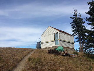 Dodger Point fire lookout cabin 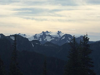 Mt. Olympus from Dodger Point 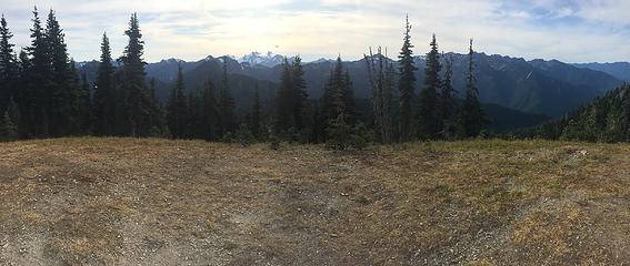 Mt. Olympus and Bailey Range, from Dodger Point 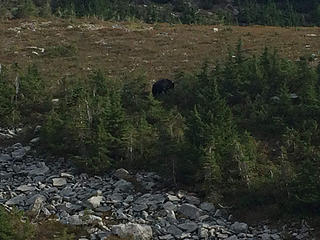 Black bear, just north of Dodger Point 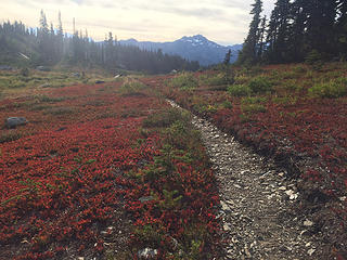 Stephen Peak (?) and lovely fall colors 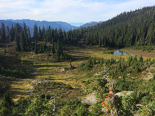 Tiny ponds about a mile north of Dodger Point on the Long Ridge trail; the wider gap in the trees towards the left is roughly where I camped 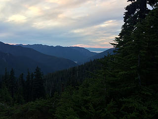 View of the Strait of Juan de Fuca, from near camp 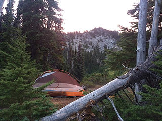 View of Dodger Point's ridge, from camp 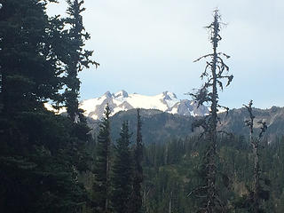 Mt. Olympus, from Long Ridge trail 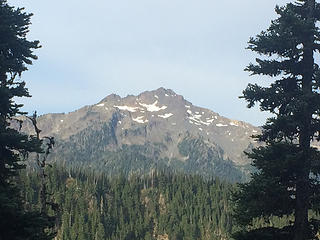 Stephen Peak (?), from Long Ridge trail 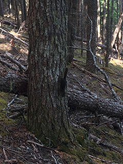 Very loud and agitated squirrel, Long Ridge trail 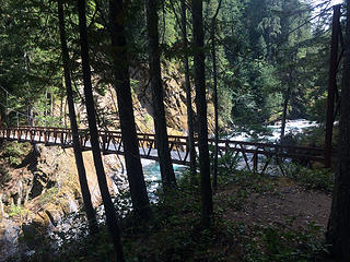 Elwha River canyon bridge 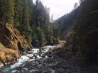 Elwha River canyon, from bridge 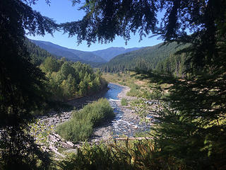 Elwha River from near the canyon bridge, looking to Humes Ranch area
|
| Back to top |
  
|
|
meck
Member

Joined: 31 Dec 2010
Posts: 920 | TRs | Pics
|
|
meck
Member
|
Sun Sep 24, 2017 2:51 pm |
|
|
Very cool Double_E, I really want to give that primitive-trail a try. After fording did you note if there was any better looking crossing location, or were you pretty much directly in front of the cabin?
*Just say NO to Rent-Seeking, don't give up the concept of "ownership"*
*Just say NO to Rent-Seeking, don't give up the concept of "ownership"*
|
| Back to top |
|
|
Double_E
Member
Joined: 21 Jul 2005
Posts: 36 | TRs | Pics
Location: Seattle |
|
Double_E
Member
|
Mon Oct 09, 2017 10:45 am |
|
|
Original post finally updated with more info and pics.
| meck wrote: | | Very cool Double_E, I really want to give that primitive-trail a try. After fording did you note if there was any better looking crossing location, or were you pretty much directly in front of the cabin? |
No, didnt go too far up or downstream. Close by upstream was a deep pool and cliff; downstream might have had better options though
?
|
| Back to top |
|
|
RodF
Member

Joined: 01 Sep 2007
Posts: 2593 | TRs | Pics
Location: Sequim WA |
|
RodF
Member
|
Wed Oct 11, 2017 3:30 pm |
|
|
Thanks for sharing your pics, Double_E! Dodger LO sure looks great, buttoned down for winter.
p.s. your pic of Elkhorn RS shows the ends of the sill and lower two logs replaced last year, when the entire floor was removed, its stringers and other sills were replaced, and floor reinstalled. Another save for the next generation. Now we just need a trail linking them that can be found! 
"of all the paths you take in life, make sure a few of them are dirt" - John Muir
"the wild is not the opposite of cultivated. It is the opposite of the captivated - Vandana Shiva
"of all the paths you take in life, make sure a few of them are dirt" - John Muir
"the wild is not the opposite of cultivated. It is the opposite of the captivated - Vandana Shiva
|
| Back to top |
|
|
|
|
You cannot post new topics in this forum
You cannot reply to topics in this forum
You cannot edit your posts in this forum
You cannot delete your posts in this forum
You cannot vote in polls in this forum
|
Disclosure: As an Amazon Associate NWHikers.net earns from qualifying purchases when you use our link(s). |


