| Previous :: Next Topic |
| Author |
Message |
Gimpilator
infinity/21M


Joined: 12 Oct 2006
Posts: 1688 | TRs | Pics
Location: Edmonds, WA |
Went with John for a few south BC peaks. We did 6 peaks in 4 days. First day omitted becuase it was less interesing. Some new fires gave our itinerary a new dirtection. Everything seen here was impromtu, not part of the original plan.
6-4
Hope Mountain - 6050'
If you can make the drive up the steep logging road, then you can probably hike the trail up Hope Mountain. We saw only trucks at the trailhead, and more bears on the road (3) than trucks. There is one crux area where you cross some downsloping rock with exposure on a ledge. The ledge was wet and muddy for us.
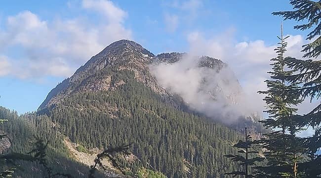 Hope 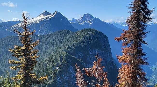 Wells, Grant 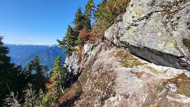 ledge 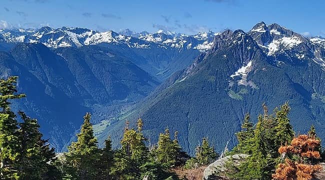 Isolillock at right 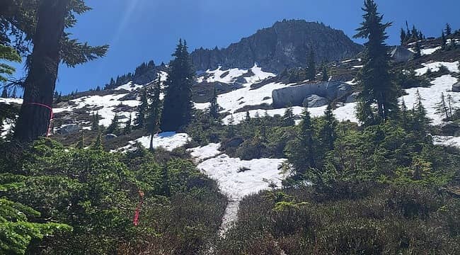 Wells 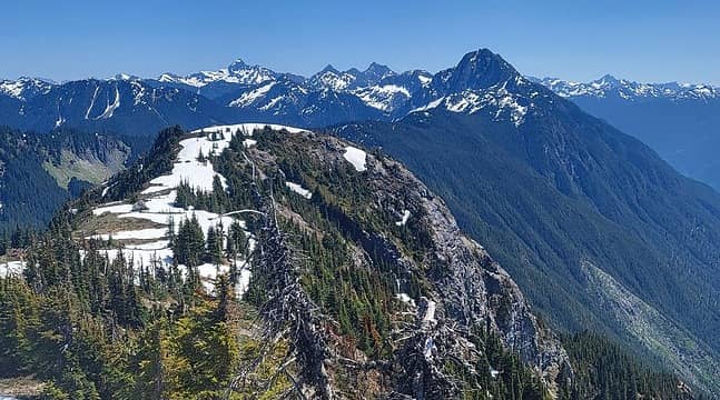 Silvertip, Rideout, Payne, Grant 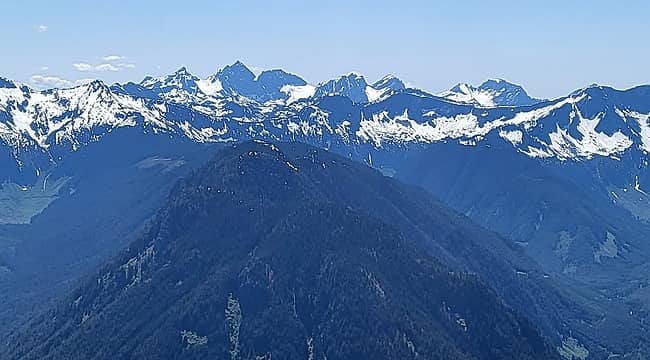 Foley, Welch, The Still, Baby Munday, Knight, Lady 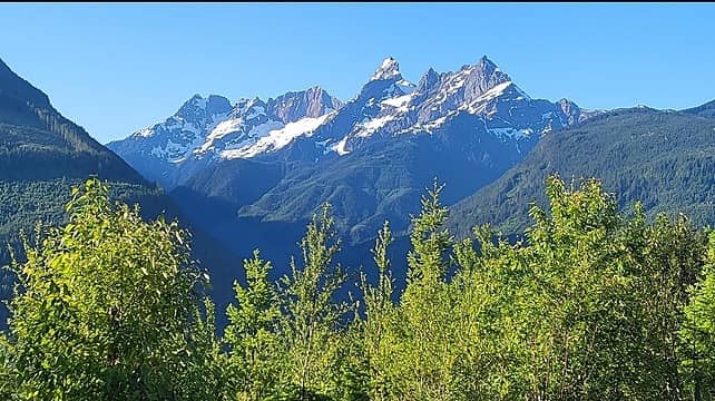 A nice view of (Pleiades, Larrabee, American Border, Canadian Border) from our secret camp spot 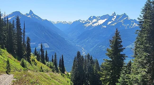 the North Cascade sentinals, Slesse on the left and American Border on the right 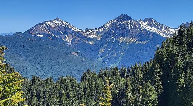 Cheam and Lady 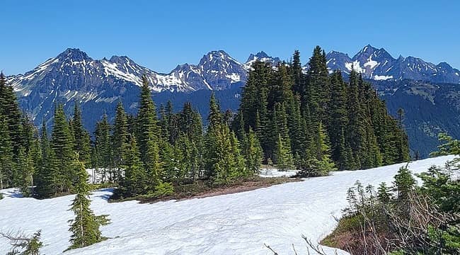 Welch group from the summit 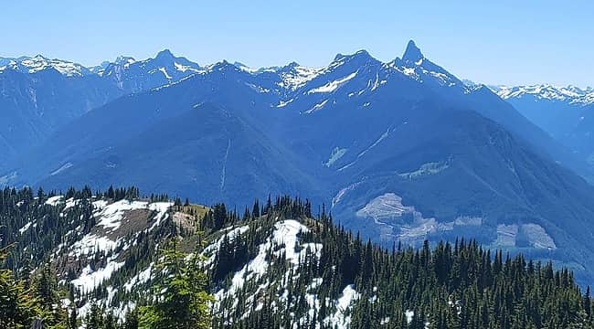 Rexford and Slesse 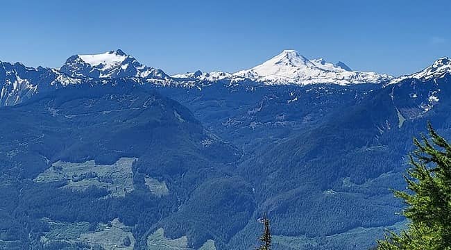 Tomyhoi and Baker 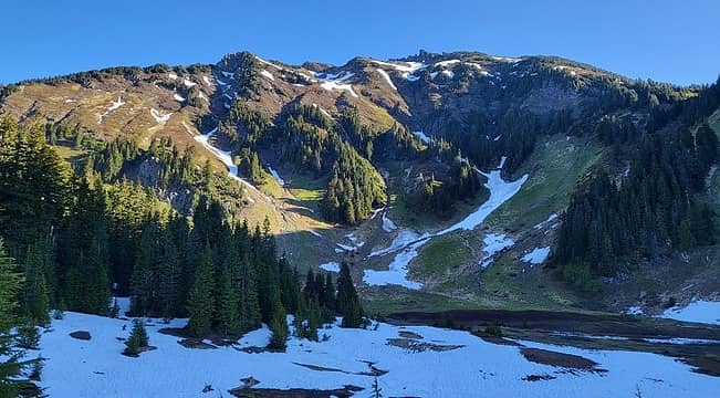 Cheam from an upper basin 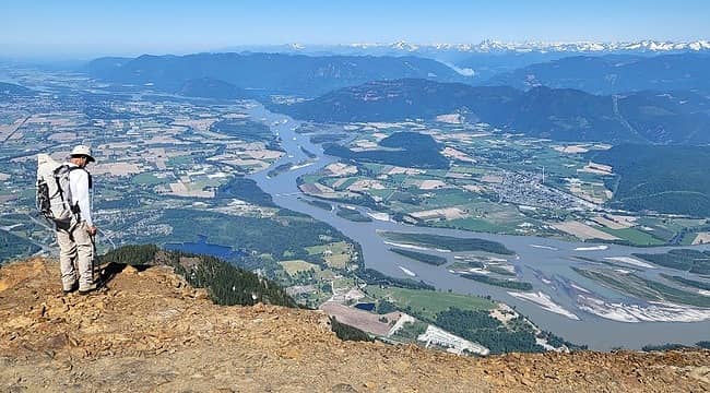 Fraser valley 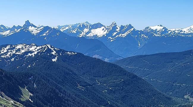 Slesse, Blum, Shuksan, Larrabee, American Border, Canadian Border, Tomyhoi 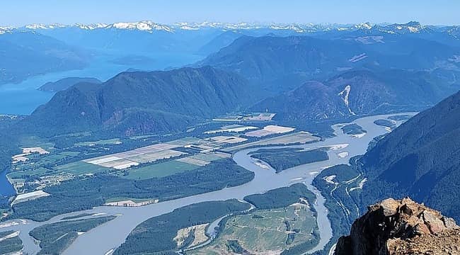 Harrison Lake 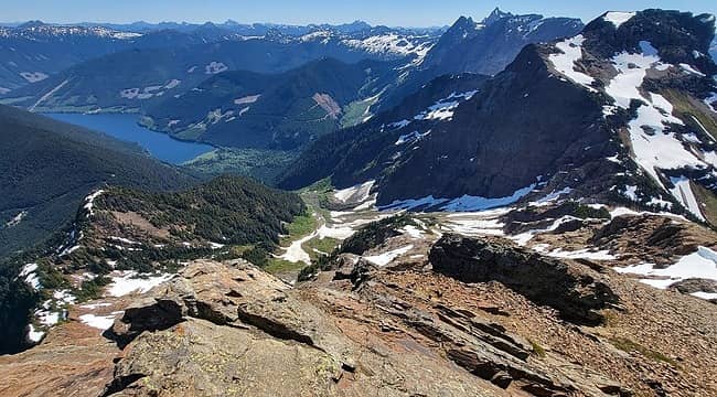 main stuff seen here is Wahleach Lake, Jarvis, Outram, Welch, Lady 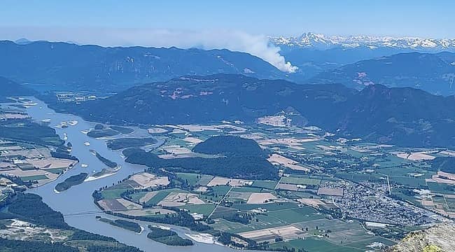 a new fire
|
| Back to top |
  
|
|
Now I Fly
Member
Joined: 07 Jun 2018
Posts: 490 | TRs | Pics
|
Wow! Need to head North! Thanks for the report!
 Gimpilator Gimpilator
Gimpilator |
| Back to top |
|
|
Stefan
Member

Joined: 17 Dec 2001
Posts: 5095 | TRs | Pics
|
|
Stefan
Member
|
 Tue Jun 13, 2023 9:43 am |
|
|
Thanks for confirming the roads are still just as bad!
|
| Back to top |
|
|
fourteen410
Member

Joined: 23 May 2008
Posts: 2635 | TRs | Pics
|
| Gimpilator wrote: | a new fire |
 Looks like you had a quiet day on Cheam. From what I understand, it's the Chilliwack version of Si/Mailbox in terms of popularity once it melts out. It sounds like you were able to drive up to the trailhead though?
|
| Back to top |
|
|
Gimpilator
infinity/21M
Joined: 12 Oct 2006
Posts: 1688 | TRs | Pics
Location: Edmonds, WA |
The road was sort of OK, aside from the water bars. However there was one bad section that we tried in John's Tacoma and couldn't make it. That left about 2 miles of road walking to the trailhead. Another truck parked there after us. Please look up my peakbagger track log to find the exact spot we started.
|
| Back to top |
|
|
|
|
You cannot post new topics in this forum
You cannot reply to topics in this forum
You cannot edit your posts in this forum
You cannot delete your posts in this forum
You cannot vote in polls in this forum
|
Disclosure: As an Amazon Associate NWHikers.net earns from qualifying purchases when you use our link(s). |


