| Previous :: Next Topic |
| Author |
Message |
peter707
Member

Joined: 16 Jun 2022
Posts: 139 | TRs | Pics
Location: Seattle, WA |
|
peter707
Member
|
 Wed Jun 28, 2023 9:31 am |
|
|
The snow would be consolidated, the glacier would be covered, and the weather forecast was good. With any luck, there might even be a bootpack. Sunday seemed like the right time for Glacier Peak! Glacier Peak (10,541′) was also my final WA volcano (5/5), so I was excited to have an attempt at finishing my current peak list.
The standard Glacier Peak route has a few variations on how to handle Disappointment Peak, the Glacier Route vs the Scramble Route.
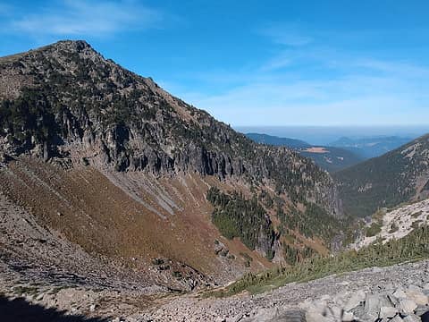
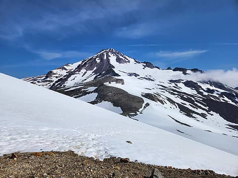 Glacier Peak 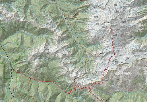 North Fork Sauk Trail, White Pass, PCT, White Chuck Glacier, Glacier Gap, Suiattle Glacier, Cool Glacier, Glacier Peak 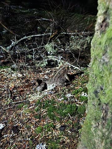 Giant Toad on the approach 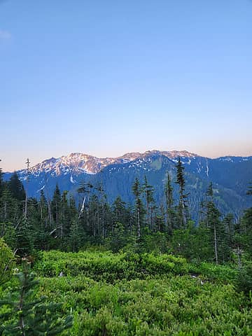 Alpenglow 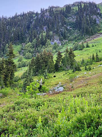 Bear 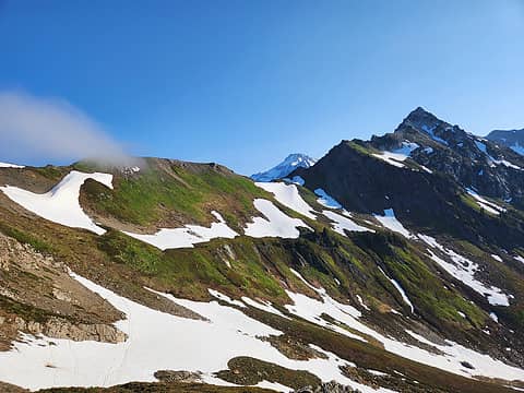 Glacier Peak looking far away 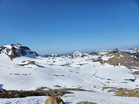 Snow-covered Lake 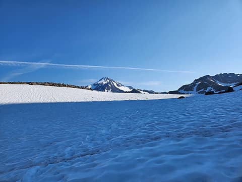 Glacier Peak still looks far away  On the mountain at last! 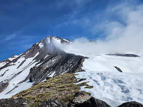 Disappointment Peak looms 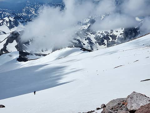 Suiattle Glacier 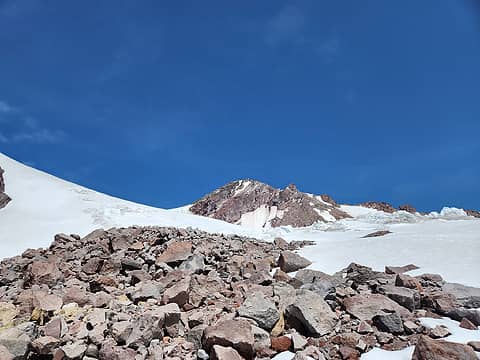 Suspect Glacier Transition 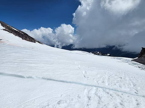 Cool Glacier - Small Cracks Appearing 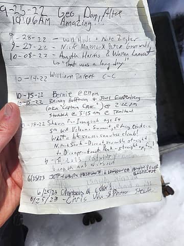 Found Joel Gartenberg on the Summit Register 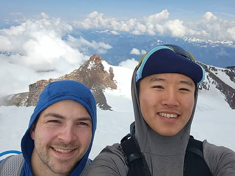 Got up there! 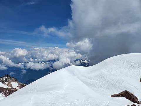 Concerning clouds 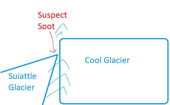 Illustration of the Cool-Suiattle Glacier Transition 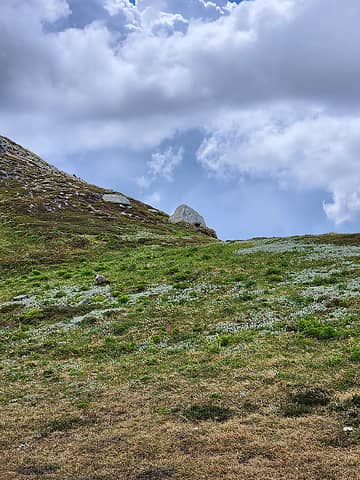 Marmot 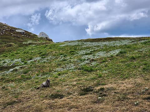 Marmot
 Now I Fly, Roly Poly, HikingBex, contour5, Pef, ALW Hiker, JimK, Tom, awilsondc, williswall, Songs2, John Mac, fffej50, jaysway, Slim, nuclear_eggset, Bronco Now I Fly, Roly Poly, HikingBex, contour5, Pef, ALW Hiker, JimK, Tom, awilsondc, williswall, Songs2, John Mac, fffej50, jaysway, Slim, nuclear_eggset, Bronco  SpookyKite89, KascadeFlat, zimmertr SpookyKite89, KascadeFlat, zimmertr
Now I Fly, Roly Poly, HikingBex, contour5, Pef, ALW Hiker, JimK, Tom, awilsondc, williswall, Songs2, John Mac, fffej50, jaysway, Slim, nuclear_eggset, Bronco SpookyKite89, KascadeFlat, zimmertr |
| Back to top |
  
|
|
awilsondc
Member

Joined: 03 Apr 2016
Posts: 1324 | TRs | Pics
|
Nice job! That's a big day. Those last five miles back to the car are really annoying when you're fatigued like that. Congrats on finishing the WA volcanoes!
Now I Fly, peter707
Now I Fly, peter707 |
| Back to top |
|
|
Exmoor
Member

Joined: 20 Mar 2013
Posts: 89 | TRs | Pics
Location: Snohomish |
|
Exmoor
Member
|
Thu Jul 06, 2023 3:11 pm |
|
|
Appreciate the report. I've been thinking about doing this one in one shot myself, and its very useful to have the Strava tracks to see exactly what the distances and elevations involved are.
That last section from where the trail flattens out near the old shelter to the trailhead are the worst. Feels like you're almost done for hours. I had to come in from Meander Meadow a few years ago due to a fire closure and despite being much, much further it was almost worth it just not having to trudge through those last 6 miles (although the end of Meander Meadow is a similar slog).
peter707
peter707 |
| Back to top |
|
|
|
|
You cannot post new topics in this forum
You cannot reply to topics in this forum
You cannot edit your posts in this forum
You cannot delete your posts in this forum
You cannot vote in polls in this forum
|
Disclosure: As an Amazon Associate NWHikers.net earns from qualifying purchases when you use our link(s). |


